A vast Maya city hidden beneath the forests of eastern Campeche, Mexico, has been identified not through a jungle expedition, but by revisiting old lidar data collected for an entirely different purpose. The site, now called Valeriana, had been sitting unnoticed in a 2013 environmental survey for more than a decade.
The discovery, published in the journal Antiquity, is drawing attention not only because of the city itself, but because of how it was found. Instead of uncovering new evidence in the field, researchers found it in a digital archive that had already been available for years.
Over the last decade, lidar has transformed Maya archaeology by revealing settlements hidden beneath dense vegetation. Yet Valeriana suggests that some of the next major discoveries may come from reexamining existing datasets rather than launching new surveys.
A Graduate Student Spotted What Others Had Missed
The breakthrough began with Luke Auld-Thomas, then a doctoral student at Tulane University. While searching online, he came across a lidar survey that had been carried out in 2013 by a conservation organization focused on forest and carbon monitoring.
“I was on something like page 16 of Google search and found a laser survey done by a Mexican organisation for environmental monitoring,” he said.
As reported in Antiquity, the dataset was never intended for archaeology. But after processing the information using archaeological techniques, Auld-Thomas noticed patterns that pointed to something much larger than natural terrain features.
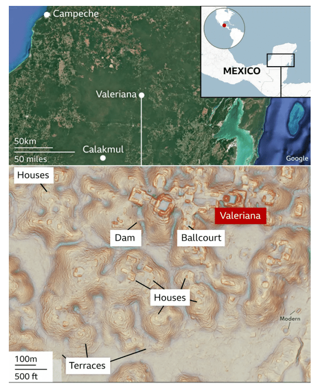
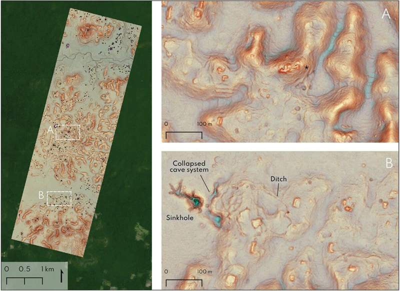
Lidar works by firing hundreds of thousands of laser pulses from an aircraft. Some of those beams make their way through gaps in the forest canopy and reach the ground. Once the vegetation is digitally removed, ancient structures can suddenly become visible. The survey covered around 122 square kilometers and revealed 6,764 structures, giving an average density of roughly 55 structures per square kilometer. Hidden beneath the trees was what researchers identified as a major Maya urban center.
Inside the Ancient City Hidden Beneath the Landscape
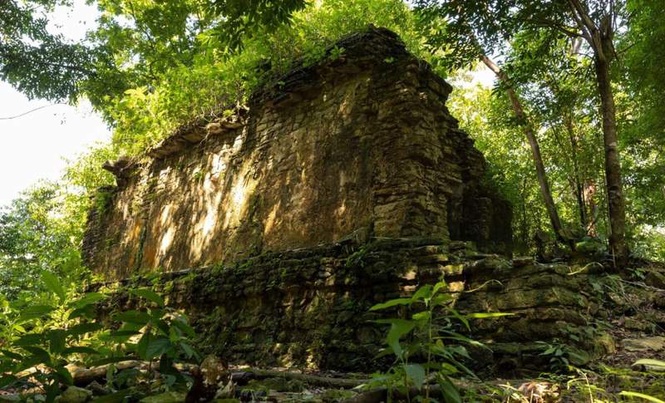
The lidar images revealed many of the features archaeologists expect to find in an important Classic Maya city. Researchers identified two monumental precincts, large enclosed plazas connected by a broad causeway, temple pyramids, a ball court, and a reservoir created by damming a seasonal watercourse.
Data cited by BBC indicates that some estimates place the city’s population between 30,000 and 50,000 inhabitants during its peak between 750 and 850 AD. These figures are based on settlement density rather than direct evidence from excavations.
The name once used by the city’s inhabitants has not survived. Modern researchers adopted the name Valeriana, inspired by a nearby lagoon, in a region where archaeologists had been aware of Maya traces for many years.
In comments referenced by the source material, Auld-Thomas said the find confirmed what he expected to see rather than overturning previous ideas about the region.
The Data May Matter More Than the City Itself
The lidar survey had existed for years before anyone analyzed it from an archaeological perspective. The study team argue that lidar data is regularly collected for forestry, agriculture, conservation, mining and infrastructure projects. Much of it is never examined by specialists interested in what might be hidden beneath vegetation.
Valeriana stands out because the survey was not designed to find ancient ruins. It was collected for environmental monitoring, then later reinterpreted through a different scientific lens.
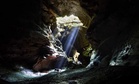
Researchers still plan to verify the findings through fieldwork. Lidar can reveal the outlines of buildings and infrastructure, but only investigations on the ground can determine when those structures were occupied and how they fit into the history of the Maya world.
“I’ve got to go to Valeriana at some point. It’s so close to the road, how could you not? But I can’t say we will do a project there,” stated Auld-Thomas.”One of the downsides of discovering lots of new Maya cities in the era of Lidar is that there are more of them than we can ever hope to study.”