
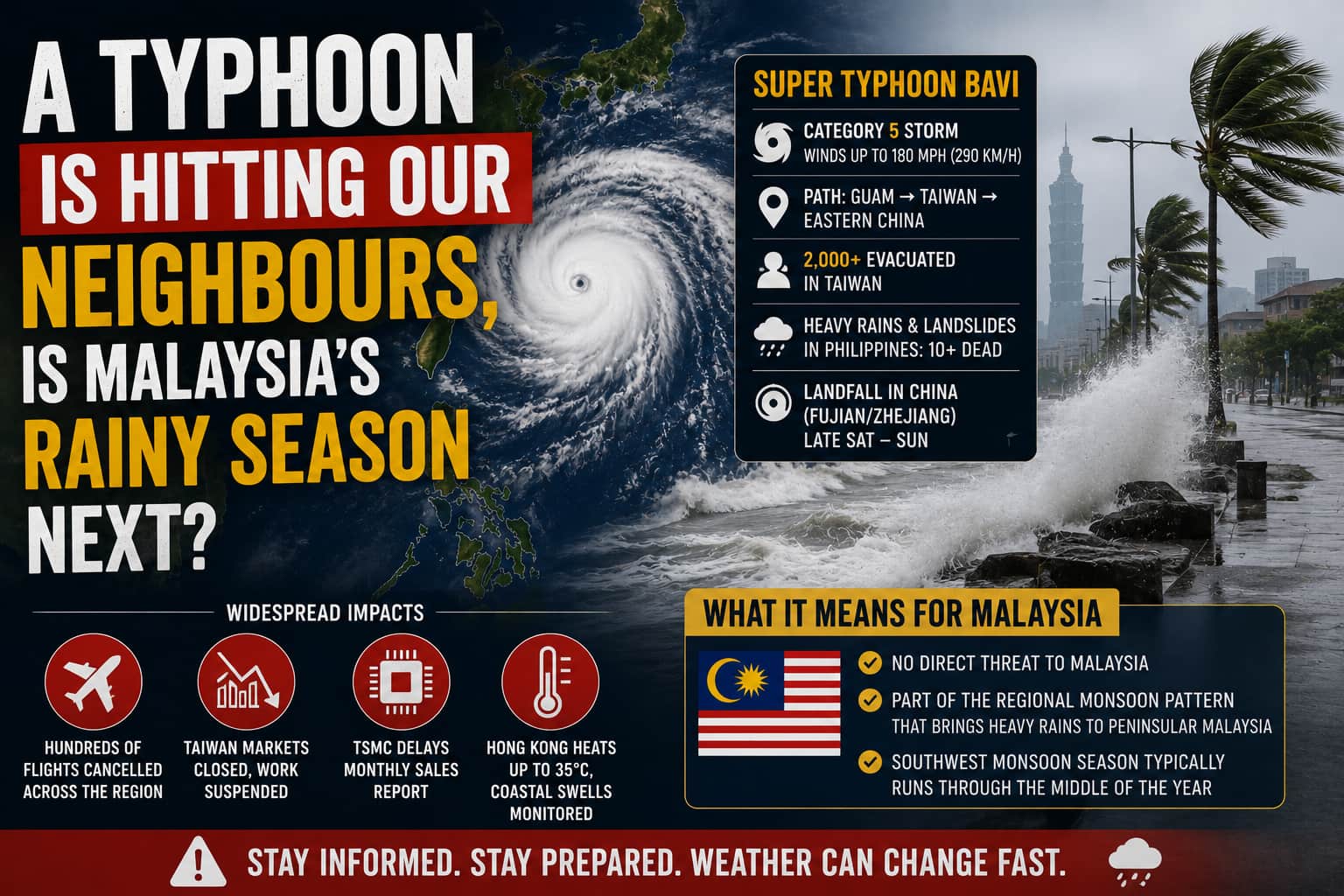
Super Typhoon Bavi has spent the past week carving a destructive path across the western Pacific, and by the weekend it was bearing down on Taiwan and eastern China after already battering Guam and the Northern Mariana Islands at Category 5 intensity. The storm passed close to Japan's Sakishima Islands early Saturday with sustained winds near 162 kilometres per hour, prompting Taiwan to close its financial markets, suspend work across large parts of the north and east, and evacuate more than 2,000 people, mostly from mountainous areas at risk of landslides.
Bavi's path started far from any of the places now bracing for it. The storm first struck Rota, in the Northern Mariana Islands near Guam, at Category 5 intensity, becoming the first typhoon on record whose eye passed directly over that particular island, with peak sustained winds near 180 miles per hour tearing down communications towers and stripping trees bare. Local officials described it as the most severe storm the area had seen in about 30 years, a comparison that carried real weight given the region's long history with intense Pacific typhoons.
Bavi's reach extended well beyond its own centre. In the Philippines, the storm strengthened a southwest monsoon system that dumped heavy rain across Mindanao, triggering a landslide that killed at least ten people, part of a wider death toll from related flooding and landslides across the region. Airlines cancelled hundreds of flights across Japan, Taiwan, and China, and Taiwan Semiconductor Manufacturing Company, the world's largest contract chipmaker, pushed back its scheduled monthly sales report because of typhoon related disruptions. Hong Kong, though well outside Bavi's direct path, still felt its influence, with the storm's outer bands pushing temperatures up to 35 degrees Celsius over the weekend while authorities monitored coastal swells closely enough to consider issuing a strong monsoon signal.
Bavi is forecast to make landfall along China's eastern coast, somewhere around Fujian or Zhejiang province, late Saturday or early Sunday local time, by which point it's expected to have weakened considerably from its earlier peak intensity. Coastal fishing communities there spent the lead up to landfall hauling boats ashore and securing property, the same preparations playing out up and down the coastline that Japan and Taiwan had already gone through days earlier.
For Malaysia, Bavi itself poses no direct threat since it's tracking well north of the country toward China's eastern coastline. But the storm is a useful marker for where we sit in the regional weather calendar. Malaysia's own southwest monsoon season typically runs through the middle of the year, and while we don't get typhoons directly, the broader monsoon patterns that fuel storms like Bavi in the Philippines and the South China Sea often correlate with the heavier rain spells Peninsular Malaysia sees during the same stretch of months.
It's the kind of story that doesn't touch Malaysian shores but is still worth watching, both for the human toll unfolding in our immediate neighbourhood and for what it says about how active this year's regional storm season has already become.
Ronny M (ronny76netstuff@gmail.com) is a content creator under the Newswav Creator programme, where you get to express yourself, be a citizen journalist, and at the same time monetize your content & reach millions of users on Newswav. Log in to creator.newswav.com and become a Newswav Creator now!
The User Content (as defined on Newswav Terms of Use) above including the views expressed and media (pictures, videos, citations etc) were submitted & posted by the author. Newswav is solely an aggregation platform that hosts the User Content. If you have any questions about the content, copyright or other issues of the work, please contact creator@newswav.com.
