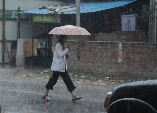
Chandigarh’s third driest June in the past 14 years gave way to a wet start to July on Wednesday as the southwest monsoon finally arrived over the city, bringing widespread rain, a sharp fall in temperatures and signalling the beginning of a sustained wet spell after weeks of scorching heat and failed pre-monsoon weather alerts.
According to the India Meteorological Department (IMD), the southwest monsoon advanced into Chandigarh on Wednesday, nearly a week behind its normal schedule. The weather office said conditions were favourable for its further advance over the remaining parts of the region during the next two days.
The monsoon arrived after an exceptionally dry June. The IMD’s monthly weather summary shows Chandigarh received just 39.3 mm of rainfall during June against the normal 155.5 mm, leaving the city with a 75 per cent rainfall deficit and making June 2026 the third driest June in the last 14 years, behind only 2024 (11.9 mm) and 2019 (24.8 mm). In sharp contrast, June last year had received 213 mm of rainfall, highlighting the magnitude of this year’s pre-monsoon shortfall.
Wednesday’s rain, therefore, marked a break from the prolonged dry spell.
Between 8.30 am and 5.30 pm, Chandigarh city recorded 10.2 mm rainfall, Chandigarh airport 22 mm and Mohali 21 mm, making the Tricity the wettest pocket in Punjab and Haryana during the day.
The rain also produced a dramatic fall in temperatures. Chandigarh’s maximum temperature plunged to 29.7°C, down 7.3 degrees Celsius from Tuesday and 5.8 degrees below normal, while Mohali recorded 28.8°C, a decline of 6.6 degrees. Chandigarh airport reported 28.9°C, 6.4 degrees lower than the previous day and 6.6 degrees below normal.
Night temperatures also moderated. Chandigarh’s minimum temperature fell by 2.4 degrees to 27.4°C, while Mohali recorded 28.3°C, down 2.3 degrees. Despite the cooling, minimum temperatures remained marginally above normal because of increased atmospheric moisture associated with the monsoon.
The IMD has now issued a yellow alert from Thursday through next Tuesday for heavy rain, thunderstorms, lightning and gusty winds of 40-50 kmph over Chandigarh, indicating that the city has entered an active monsoon phase. The weather office has forecast light to moderate rainfall at many places with isolated heavy spells during the period.
For Chandigarh, Mohali and Panchkula, partly cloudy skies accompanied by thunderstorms and rain are expected over the next five days. Maximum temperatures are forecast to remain between 32°C and 34°C, while minimum temperatures are likely to stay in the 24-25°C range, well below the levels recorded during the prolonged heat spell.
A meteorologist said the onset of the southwest monsoon marks a clear shift from the prolonged pre-monsoon phase. “The delayed arrival of the southwest monsoon prolonged dry weather through June, resulting in a large rainfall deficit. With the monsoon now reaching Chandigarh, the weather pattern has changed significantly. Frequent spells of rain, thunderstorms and isolated heavy rainfall are likely over the next several days, which will keep daytime temperatures below normal and help recover part of the seasonal rainfall deficit,” he said.
After ending June as one of its driest in more than a decade, Chandigarh has begun July on a markedly different note, with the monsoon finally setting in and the IMD forecasting an active first week of the season.