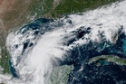
El Nino strengthened in September to become the strongest example of the phenomenon on record, Japan’s weather agency has said, and is now certain to continue throughout winter.
The Japan Meteorological Agency said on Friday the sea surface temperature in the area of the Pacific Ocean it monitors for El Nino was 4.0C above normal.
That is the highest reading since records began in 1949. It exceeded the previous record of 3.6C, set in December 1997. The agency expects the reading to keep rising until the Northern Hemisphere winter, when it said the event was likely to peak at a record level.
Forecasters have warned for months that this year’s El Nino could be the strongest on record and have dubbed it a “super El Nino”.
El Nino is the warm phase of the naturally occurring El Nino-Southern Oscillation cycle, a climate pattern that influences weather around the world. It tends to cause higher global temperatures and disrupt rainfall patterns across large regions – meaning drought in some areas and heavy rains in others. It typically occurs every two to seven years.
Japan’s warning comes after the World Meteorological Organisation (WMO), the United Nations weather agency, said on Thursday that El Nino would keep intensifying until it peaks around December.
“WMO forecasts indicate a near-100 per cent likelihood that it will persist through February 2027, potentially being one of the strongest since at least 1950,” Celeste Saulo, the WMO’s secretary general, had said.
The Japanese agency said temperatures in September were above normal from the southern Philippines to Java in Indonesia, while rainfall was below normal in northern South America, northern Australia, and southeastern Southeast -East Asia, a pattern it said matched that seen in past El Nino events.
Researchers at the University of Chicago’s Climate Impact Lab estimated in a report last month that heat linked to the event could cause as many as 451,000 excess deaths worldwide between June and February 2027.

The lab said the number of extremely hot days would rise by 44 per cent compared with normal years. The figure is a projection based on modelled increases in extreme heat.
August 2026 tied with July 2023 as the hottest month on record globally, with an average surface air temperature of 16.96C worldwide, according to the EU’s Copernicus Climate Change Service.
Copernicus said in its monthly bulletin, published in September, that exceptionally high temperatures persisted across much of the tropical Pacific as El Nino intensified.
Read MoreIndonesian haze makes Singapore the most polluted city in the world
Vibrant but unpredictable autumn colour on way after drought – National Trust
Climate disasters driving child marriage and teen pregnancy, major study finds