
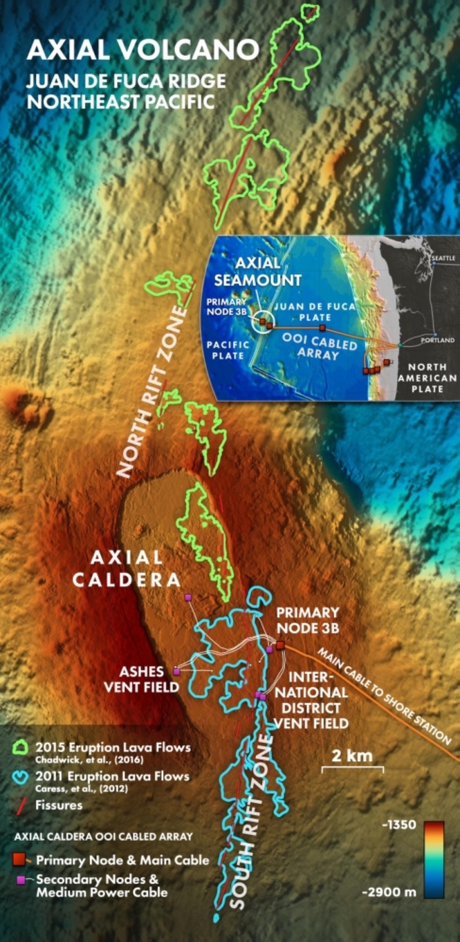
AXIAL Seamount is one of the most instrumented volcanoes in the world, located about 480 kilometers west of Oregon along the Juan de Fuca Ridge, where tectonic plates are spreading and magma rises to form new oceanic crust.
Monitoring is carried out through the Ocean Observatories Initiative, funded by the National Science Foundation, using a Regional Cabled Array that delivers continuous real-time data from seafloor instruments, including seismometers, pressure sensors, and temperature probes. Scientific analysis is led by researchers from the University of Washington, with additional contributions from NOAA and the United States Geological Survey.
Current projections indicate a likely eruption window in mid- to late-2026 based on inflation thresholds and seismic trends. The system is being treated as a predictive environment, where models are tested against live data prior to eruption. This approach reflects a broader shift in volcano monitoring, where continuous data streams are analyzed in near real time rather than interpreted after discrete events.
At Kīlauea, monitoring by the United States Geological Survey relies on dense seismic networks, satellite deformation measurements, and gas observations. Automated systems process continuous data to identify seismic swarms and ground deformation, allowing rapid assessment of whether magma is intruding, remaining at depth, or reaching the surface. The volume and frequency of activity have made automated processing necessary for operational response.
In Indonesia, increased seismicity at Mount Tambora from late 2025 into early 2026 has been linked to deep magma movement. Alert levels have been raised based on subsurface signals rather than surface activity, indicating a monitoring approach that prioritizes early detection of internal changes within the volcanic system.
Recent research is also being integrated into monitoring practice. A 2026 study introduced a seismic detection method capable of identifying very small ground accelerations associated with magma intrusion, improving short-term forecasting capability. Artificial intelligence has also been used to construct three-dimensional models of volcanic interiors from seismic datasets, as demonstrated at Popocatépetl, improving understanding of magma pathways and signal interpretation.
In Iceland, eruptions on the Reykjanes Peninsula near Grindavík from 2023 to 2025 demonstrated how combined seismic and deformation data can support rapid response. Magma intrusion was detected prior to eruption, allowing evacuations and infrastructure protection measures to be implemented. Monitoring systems integrate seismic data, satellite radar, and GPS measurements, with outputs updated continuously.
Studies based on eruptions such as La Palma have shown that deep learning models can classify volcanic seismic signals with high accuracy and track changes in eruptive phases in near real time. Other work combines data from multiple monitoring stations to detect and categorize signal types simultaneously, while satellite-based systems are being developed to identify ash plumes and thermal anomalies automatically.
At Campi Flegrei, machine learning has been used to process continuous seismic records, identifying significantly more low-magnitude earthquakes than conventional methods. This has improved mapping of subsurface structures, including fault systems associated with ground deformation and seismic swarms. At Mount Etna, long-term seismic datasets have been used to analyze changes in earthquake frequency distributions, with variations linked to magma movement toward the surface.
Across these examples, monitoring systems rely on continuous data acquisition, automated interpretation, and iterative model updates. The differences between locations reflect monitoring conditions rather than changes in methodology, with similar analytical approaches now applied across submarine, continental, and island volcanic systems.