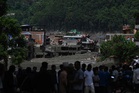
On July 8, 2025, a sudden flood swept down the Lhende River and into the Bhote Koshi, devastating the Rasuwagadhi border area in Nepal's Rasuwa district. At least nine people were killed and 19 were reported missing. Houses, buildings, bridges and hydropower facilities were swept away or damaged, while vehicles and cargo containers were buried in mud.
A year, 1 month and 19 days later, a ice-rock avalanche caused a much larger flash flood in roughly the same area.
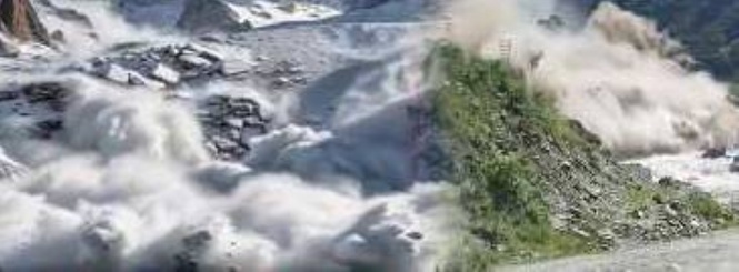
Satellite analysis reported by The Guardian showed a large section of glacier and underlying rock breaking away at about 5,200 meters. The failed section covered around 0.2 square kilometer and fell roughly 1,200 meters before reaching the valley floor. It picked up rock and sediment during the descent and formed a debris flow.
According to the International Centre for Integrated Mountain Development (ICIMOD), the avalanche may have temporarily blocked the Lhende Khola. Water accumulated behind the blockage before it failed, sending water and debris into the Bhote Koshi and then the Trishuli river system.
Just last year
The 2025 disaster was a glacial lake outburst flood, or GLOF proven by an investigation by Nepal's Department of Hydrology and Meteorology (DHM) and ICIMOD. The agencies found that a previously unnoticed supraglacial lake on the Purepu Glacier in Tibet had suddenly drained. The lake was about 36 kilometers upstream of Rasuwagadhi at an elevation of about 5,150 meters.
Nepal's National Disaster Risk Reduction and Management Authority classified the July 8 disaster as a flash flood caused by the rapid discharge of the lake.
The flood swept away the Friendship Bridge linking Nepal and China, damaged the Rasuwagadhi Hydropower Project and other hydropower facilities, buried vehicles and cargo containers in mud and cut the road connecting Nepal with Tibet.
Massive floodwaters
The 2026 flood wave rose rapidly as it moved through the river system. ICIMOD said hydrological observations showed an "exceptional" speed and magnitude. At Galchhi, roughly 100 kilometers downstream, the Trishuli River rose by as much as 9 meters in 30 minutes.
Reuters reported that the avalanche debris traveled at roughly 50 meters per second, or about 180 kilometers per hour.
The surge carried large quantities of sediment and boulders. The steep valleys confined the flow, allowing the material to move rapidly through populated areas. Nepal's disaster management authority said the destruction spread through "the Rasuwa district, particularly Timure, Rasuwagadhi and Syapru Besi."
Satellite imagery from Planet Labs analyzed by Al Jazeera showed large sections of Syapru Besi submerged beneath mud. Further downstream, the flood reached communities in Nuwakot and Dhading, including Betrawati and Trishuli Bazaar. Homes, bridges and roads were swept away along the Trishuli corridor.
At least 19 bridges and about 40 kilometers of roads were reported damaged or destroyed. Eleven hydropower projects and one solar plant were affected, with 431.1 megawatts of electricity disconnected from the national grid, according to Nepal Electricity Authority figures reported by Nepali media.
Ground reporting has been difficult because hydrological gauging stations along the flood path were swept away. A preliminary report from Nepal's Flood Forecasting Division reportedly estimated that an additional 20 million cubic meters of water passed through the system at the peak of the flood.
Not an earthquake
The collapse generated a seismic signal strong enough to be detected as an earthquake.
The United States Geological Survey (USGS) initially classified a signal recorded at about 8:37 a.m. local time on Aug. 26 as a magnitude 4.4 earthquake. Early reports therefore suggested that an earthquake might have triggered the avalanche.
Further analysis found no tectonic earthquake. Data from seismic stations, long-period seismic waves and satellite imagery showed that the signal came from the glacier collapse and resulting landslide.
The mass movement generated a seismic signal equivalent to about a magnitude 5.2 event.
Large landslides and glacier collapses can generate seismic waves when enormous masses suddenly move across the ground. The seismic reading therefore did not indicate movement along an earthquake fault.