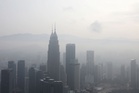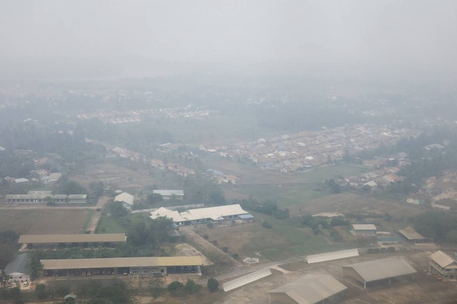
THE Department of Environment and Natural Resources' Environmental Management Bureau (DENR-EMB) said Tuesday that the haze from forest fires in Kalimantan, Indonesia, may continue to affect parts of the Philippines.
DENR-EMB Chief of Environmental Quality Management Division Jundy del Socorro said the haze is being transported by the southwest monsoon, and its effect could be felt from Sept. 1 to Sept. 3.
"The haze situation is largely beyond our control because it depends on several factors outside the Philippines, including the intensity of the forest fires in Kalimantan, prevailing wind patterns, and rainfall across the region," he said.
DENR EMB monitoring data showed that as of Sept. 1, several areas in Metro Manila recorded high PM2.5 levels, with air quality reaching very unhealthy to acutely unhealthy levels.
Del Socorro said periods of rain can help reduce pollution levels by washing smoke particles and fine particulate matter out of the atmosphere.
He added that air quality could begin improving between Sept. 4 and 6 if rainfall remains widespread and wind patterns shift. "Rain is one of the most effective natural mechanisms for removing suspended particles from the air, which can lead to better visibility and lower haze concentrations."
On Monday, classes in public schools were suspended in parts of Manila and Quezon City, while continued "unhealthy air warnings" triggered advisories across the National Capital Region.
This is not the first time a "transboundary haze" has hit the country. Two major incidents were recorded in 2015 and 2019, with toxic plumes emanating from almost the same region.
Responding to an email from The Manila Times, Indonesia’s Meteorology, Climatology and Geophysics Agency, or BMKG, confirmed fire hotspots were concentrated across West and Central Kalimantan, along with smaller clusters in Sumatra, Papua, and Maluku. Satellite tracking from NASA’s Fire Information for Resource Management System (FIRMS) using both Moderate Resolution Imaging Spectroradiometer and Visible Infrared Imaging Radiometer Suite instruments detected tens of thousands of active fire pixels across Borneo throughout August.
FIRMS also corroborated the scale of the fires using thermal sensor data that mapped intense hotspot clusters across dried peatlands and degraded forest tracts in West and Central Kalimantan, while Earth Observatory aerosol imagery tracked heavy smoke and fine particulate plumes lifting into the atmosphere and drifting westward over the Karimata Strait and northeast across the South China Sea. FIRMS supplied The Times with the latest satellite imagery of the path of the toxic fumes.
The blazes stem from agricultural land clearing combined with drained, dry peatlands. Once ignited, peat fires burn deep underground, generating massive plumes of carbon-rich fine particulate matter, known as PM2.5, that rise high into the lower troposphere. At that altitude, strong horizontal wind streams transport the suspended particulates over vast distances across open water before they can disperse or settle.
Once lofted into the atmosphere, the smoke meets the prevailing southwest monsoon, which acts as a massive atmospheric conveyor belt, catching the smoke over Borneo and hauling it across the open waters of the South China Sea directly toward the archipelago.
As early as Aug. 26, the Singapore-based Asean Specialized Meteorological Center (ASMC) raised its regional haze alert for the southern part of the region to Level 3, the highest warning stage under the Agreement on Transboundary Haze Pollution.
ASMC regional surveillance confirmed to The Manila Times that it tracked dense smoke plumes originating from hotspot clusters in Kalimantan and southern Sumatra, observing that transboundary particulate matter had already spread across West, Central, and North Kalimantan, Sabah, Sarawak, Brunei, and into parts of Palawan in the Philippines.
In an earlier statement, Philippine Atmospheric, Geophysical and Astronomical Services Administration weather specialist Benison Estareja noted that the dispersion corridor of transboundary particles can range from Central Luzon to Visayas depending on the orientation and strength of the monsoon flow.
Health agencies continue to advise the public, especially young children, senior citizens, pregnant women, and individuals with respiratory or heart conditions, to avoid outdoor exertion, keep indoor spaces closed, and wear well-fitted N95 respirators when traveling outside.