NASA’s Curiosity rover is steadily uncovering a visually and geologically complex story written into the slopes of Mount Sharp on Mars, where alternating rock “bands” signal shifts in ancient environmental conditions. According to NASA’s Curiosity blog (Sols 4920–4926), the rover has been traversing sharply contrasting terrains that vary in texture, tone, and structure as it climbs higher. These transitions are not just surface-level curiosities but potential markers of changing geological eras preserved in Martian rock.
NASA Documents A Shifting Martian Landscape
NASA reports that Curiosity’s recent traverse has moved it across a rough, dark-toned unit of bedrock where direct surface brushing was not possible due to its texture. Instead, the rover relied on contact science tools such as APXS and MAHLI to examine targets including “Salto La Cascada,” “Puerto de Rosas,” and “Santa Gracia.” These instruments allowed scientists to analyze chemical composition and capture microscopic textures without altering the surface. At the same time, ChemCam performed laser-induced breakdown spectroscopy on multiple targets, including layered float rocks and in-place bedrock, helping to map compositional differences across the band.
The combination of imaging, chemistry, and remote sensing builds a multi-layered dataset that helps define how sharply these rock units differ from one another. Each measurement adds context to a terrain that appears deceptively uniform from orbit but reveals complexity at rover scale. The transition between bands suggests environmental changes that may have influenced sediment deposition over long periods of Martian history.
Traversing Mount Sharp’s Layered Architecture
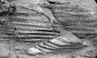
As Curiosity advanced, it encountered a series of visually distinct formations including buttes, troughs, and layered outcrops with alternating dark and light tones. Features such as “Valle Grande,” “Kimsa Chata,” and “Miraflores” were documented through Mastcam mosaics that captured fine-scale layering and surface morphology. One particularly notable formation showed ragged dark rocks juxtaposed with dust accumulation patterns, indicating ongoing surface modification processes such as wind transport.
The rover also collected long-distance imaging of distant features like “Mishe Mokwa,” revealing broader context for the banded terrain. These observations help scientists distinguish between local rock layering and regional stratigraphic transitions. The terrain is not static; it reflects both ancient deposition processes and modern erosion dynamics that continue shaping the Martian surface. Each drive refines the understanding of how Mount Sharp’s slopes were built over time.
Communication Delay And Adaptive Science Planning
During this mission phase, a delay in data downlink affected planning for one of Curiosity’s drives, temporarily limiting the team’s ability to select new targets. Without updated imagery, the rover could not safely execute a fully targeted science plan for the affected sol. NASA engineers adapted by relying on autonomous systems and pre-planned activities that do not require immediate Earth-based input. The rover executed a suite of environmental observations, including a full 360-degree Mastcam mosaic and atmospheric measurements using APXS and Navcam instruments.
Automated AEGIS targeting allowed ChemCam to continue collecting laser spectroscopy data without direct human selection. This adaptive strategy ensures that scientific productivity continues even when communication windows are disrupted. The situation illustrates how Mars missions balance precision planning with autonomous resilience in a remote environment.
Continuing The Ascent Into A New Geological Zone
Following the data delay, mission planners prepared to investigate a smoother, lighter-toned band of surface materials identified ahead of Curiosity’s path. This upcoming unit is expected to differ significantly from the rougher terrain previously studied, potentially indicating a shift in sediment source or depositional environment. The rover’s continued ascent up Mount Sharp is effectively a cross-section through Martian geological history, with each layer offering clues about past climate conditions.
Scientists anticipate that these transitions may help refine models of how water once shaped Gale Crater’s interior. As Curiosity moves forward, the sequence of bands serves as a natural laboratory for studying planetary evolution on a massive scale. The mission continues to build a detailed stratigraphic map that connects surface observations with long-term planetary processes.