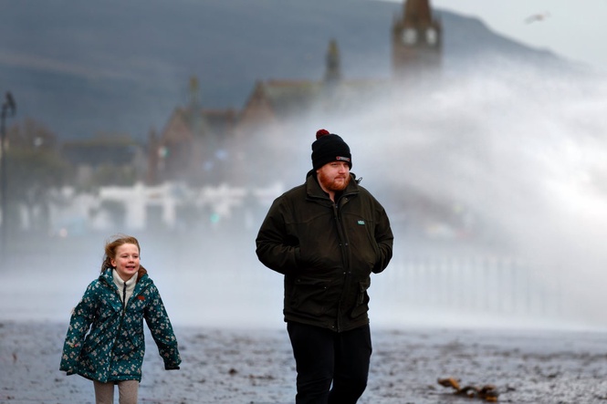
The Met Office has issued fresh yellow wind warnings across western parts of the UK for Monday and Tuesday, as gales and heavy rain threaten to cause further disruption, particularly in exposed coastal regions and over high ground.
The persistent conditions risk slowing recovery efforts following Storm Boelo, which battered northern Britain with gusts reaching 84mph and delivered a third of a month’s rain to areas of Scotland.
Two men were killed by falling trees on Sunday, namely a man in his 20s in Finchley, north London, and a 60-year-old man in Dumfries and Galloway, south-west Scotland. The victim in Scotland has been named as Richard Baines, who was the curator of Logan Botanic Garden.
In Aberfeldy, Perth and Kinross, two women were taken to hospital after being struck by another falling tree.
Power supplies were severely impacted, with 838,700 properties left without electricity during Storm Boelo and Storm Austen, which struck hours apart. By 8am on Monday, roughly 39,000 customers remained without power, the Energy Networks Association confirmed.
In Aberdeenshire, 13 primary schools without power were shut on Monday, while Ellon Academy was closed because of storm damage. Ten primary schools were shut in the Highlands.
The cleanup comes as a fresh yellow warning for wind has been issued by the Met Office, from 6pm on Monday until 3am on Tuesday.
The warning – covering parts of north-west England, Northern Ireland, south-west England, Strathclyde, south-west Scotland and Wales – forecasts gusts of 45-50mph inland and 60-65mph along exposed coasts and over high ground.
It adds that the strong winds will be accompanied by heavy rain at times, and there could be some disruption.
A yellow Met Office warning for strong winds and potentially damaging gusts is in place from 3am on Tuesday to midnight for the far north of England, Scotland, and the far north-east of Northern Ireland.
Monday will remain wet and windy as rain moves across southern and western areas before spreading north east, which brings the potential for coastal flooding particularly in northern areas, the Met Office said.
As this clears, drier conditions will develop across England and Wales later in the day.
On Tuesday, early rain will clear eastern and south-eastern England, while heavier rain in the north west of Scotland gradually turns to showers, the forecaster said.
The strongest winds will continue to affect Scotland, particularly in the far north and north west where gusts in excess of 70mph are possible.
The Hebrides are most likely to experience the strongest winds which could potentially last several hours.
Elsewhere, there will be sunny spells and showers will continue, with some heavy in western areas.
Conditions will begin to settle down from Wednesday as high pressure increasingly begins to influence the UK, the forecaster said.
This will bring lighter winds and drier weather across much of the UK on Wednesday night and Thursday, though western areas may remain breezy and experience a few light showers.
Mist and fog could be dense and slow to clear, leaving some areas chilly and grey, while brighter spells elsewhere will allow temperatures to rise into the teens.
High pressure will keep England and Wales mostly dry on Friday, with morning fog clearing to sunny spells and temperatures of 13C to 16C, the Met Office said.
Meanwhile, weather fronts moving in from the Atlantic could bring cloud and rain to western Scotland or Northern Ireland.
A north-south weather split may then develop over the weekend with rain affecting northern Britain on Saturday and into the night, while southern areas remain mostly dry under high pressure.
Mist, low cloud and fog could create murky conditions across parts of England and Wales on Halloween, so people with outdoor plans should monitor weather updates, the forecaster said.
Met Office deputy chief forecaster Steven Keates said: “While the start of this week will be notably wet and windy, high pressure is expected to bring a quieter spell of weather later in the week.
“From Wednesday, high pressure will start to build which will ease the winds and bring a quieter and largely drier end to the week for many, although some rain is still possible in the north and west.
“However, with wind warnings in place, those in warnings areas, particularly in northern Scotland and western high ground continue to be exposed to strong winds and heavy rain before the more settled weather arrives.”
Storm Boelo followed Storm Austen, which brought strong winds to southern parts of the UK on Friday.
Gusts of 76mph were recorded at St Mary’s Airport in the Isles of Scilly, with 74mph at Aberporth in South Wales and 71mph at Culdrose in Cornwall.
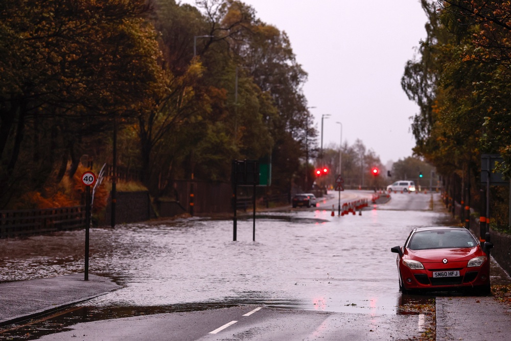
The Environment Agency on Monday issued six warnings that flooding is expected and 56 alerts where it is possible.
The Scottish Environment Protection Agency said 18 flood warnings and 13 flood alerts were in place, while Natural Resources Wales reported 12 flood alerts were active at the same time.
Read MoreWhere and when will the UK see snow fall as first flurries of winter predicted
Khan hails traffic-free Oxford Street as ‘momentous day’ for London
The new UK university rules coming into force in November
Tribute paid to 'deeply missed' curator killed by falling tree
UK’s longest canal tunnel to host ghost hunting trips this Halloween
Former police chief says Met should have reported Thomas Markle to FBI