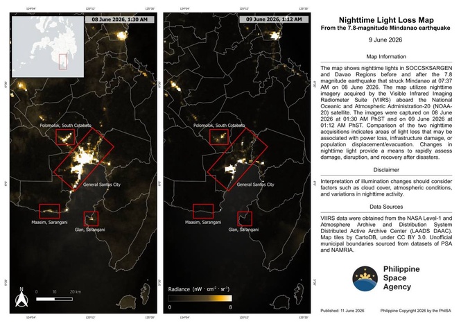
MANILA, Philippines —The Philippine Space Agency (PhilSa) has released nighttime satellite photos showing the extent of the damage of the magnitude 7.8 earthquake that struck Mindanao last June 8.
The differences in satellite imagery from June 8, 1:30 a.m. and June 9 at 1:12 am showed areas that has less nighttime light, with Philsa noting that changes in nighttime light provide a means to rapidly assess damage, disruption, and recovery after disasters.
"When lights go out, it often signals power loss, infrastructure damage, or population displacement/evacuation," Philsa said.
Philsa said that the areas that showed decrease in nighttime light were the villages of Labangal, Apopong, San Isidro, City Heights, and coastal villages Siguel and Tambler of General Santos City, coastal towns of Maasim and Glan in Sarangani, and Polomolok in South Cotabato.
The agency said that it was in the process of refining and improving the analysis toward identifying the affected areas, and noted that the return of nighttime lights may be used as proxy to monitor reconstruction and recovery.