THERE is a Japanese proverb that goes, “The next disaster strikes when the previous one has been forgotten.”
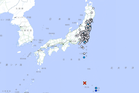
On March 11, 2011, Japan experienced a 9.0-magnitude earthquake, also known as the Great East Japan Earthquake.
Not only was it the most powerful earthquake to strike Japan, but it was also followed by a tsunami as tall as 40 meters, resulting in almost 20,000 deaths, an estimated $220 billion worth of economic damage, and a nuclear meltdown at the Fukushima Daiichi Nuclear Power Plant.
Nov. 5 is the United Nations’ World Tsunami Awareness Day. As we commemorate this international occasion, we must evaluate our preparedness for such kinds of natural hazards so that they do not become disasters.
The unpredictable nature of tsunamis
Tsunamis are not as common as typhoons. According to the US-based National Centers for Environmental Information, there have been 52 probable tsunami events in the Philippines from 1627 to 2024. In contrast, an average of 20 typhoons enter the Philippine Area of Responsibility every year, according to the Philippine Atmospheric, Geophysical and Astronomical Services Administration (Pagasa).
However, tsunamis are much harder to predict. The event is usually triggered by submarine landslides, earthquakes or volcanic eruptions. Afterward, the waves travel through the ocean at high speed with a low amplitude that makes them unnoticeable on the surface. As the tsunami approaches coastal waters, the wavelength is compressed, and the amplitude grows drastically until the wave’s height towers over human settlements.
Detection is the first line of defense
Despite our technological advancements in engineering and architecture, we remain at the mercy of the forces of nature. We will never be able to build walls strong enough to withstand a tsunami.
However, we are able to detect them in the propagation stage through a detection network. The Philippine Institute of Volcanology and Seismology (Phivolcs) has the tsunami early warning system, which makes use of gauge sensors to detect changes in sea level and water pressure in the event of seismic activity.
This is critical because local tsunamis, which are generated within 100 kilometers of the source, can strike within two to five minutes after the trigger. Meanwhile, distant tsunamis originating outside the Philippines can take one to 24 hours before reaching our shores.
Coordination is key
We may have the most advanced detection systems, but none of that will matter if the warnings do not translate into action. This is where coordination between the national government and local government is crucial.
Hazard planning is the foundation of disaster prevention. Local government units must create systems that guide citizens in the event of a tsunami. Where will people go? How will they reach evacuation centers? What will happen after the water recedes?
In Japan, various communication channels are used to disseminate tsunami warnings, such as broadcasts on TV and radio and physical loudspeakers. Traditional means of communication are still important because we cannot assume that everyone has a smartphone and internet access.
Planning and zoning for hazards
Urban planning is a powerful tool in making our communities more resilient.
We at Palafox practice what is known as ridge-to-reef planning where we treat everything, from the top of the mountains to the highlands, midlands, lowlands and coastal areas, as a single ecosystem.
Nature does not recognize political boundaries, so we must ensure that our planning is comprehensive and integrated. Applying this principle, we can identify three zones with distinct purposes.
The marine and coastal zone acts as the first line of defense, where coral reefs, mangroves, seagrass meadows and sand dunes dissipate the wave’s energy. The key term is “dissipate” because there is no single structure that can withstand the destructive force of a tsunami.
According to the US-based Khaled bin Sultan Living Oceans Foundation, extensive mangrove areas can reduce the height of tsunamis by 5 percent to 30 percent, in addition to preventing erosion. Nature-based solutions must be complemented by infrastructure such as dikes, breakwaters and seawalls.
The next area is the buffer and evacuation zone consisting of the lowlands and plains. Planners must conduct hazard mapping to ensure that critical infrastructure is situated outside of the inundation zone. Housing must also observe a coastal setback to keep people out of immediate danger.
Circulation networks also play a pivotal role. People only have so much time before a tsunami strikes, so roads must provide direct access to evacuation routes. Meanwhile, waterways and estuaries must be unobstructed to ensure the smooth flow of water back to the sea.
Lastly, the ridges and highlands are safe havens for people. Evacuation centers must be located inland and uphill with emergency shelters, communication hubs and medical supplies. Low-lying infrastructure may be damaged, so there must be an alternative source of food, water and supplies.
Address hazards before they become disasters
If the Japanese believe that “the next disaster strikes when the previous one has been forgotten,” I would like to respond with, “It is 90 percent less expensive to address hazards before they become disasters — in addition to saving human lives, property, livelihood, infrastructure and agriculture.”
Given our location along the Pacific Ring of Fire, tsunamis are an ever-present risk for our coastal communities. However, we need not fear these hazards if we observe proper planning and preparation by working with nature, not against it.
More than anything, tsunamis pose a leadership challenge for our public officials. Citizens cannot depend on the government alone, but it plays a critical role in ensuring that it uses its authority, resources and power to serve and protect its people. That is why we must support leaders who champion visionary leadership, strong political will and good governance.