

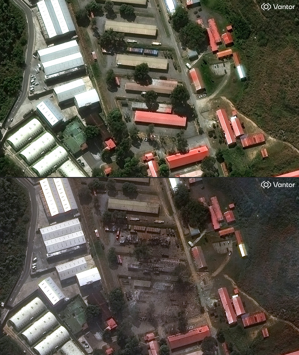
New satellite images have laid bare the devastating destruction wrought by a double earthquake in Venezuela this week.
On Wednesday 7.2 and 7.5 magnitude earthquakes struck within 39 seconds of each other west of the capital Caracas.
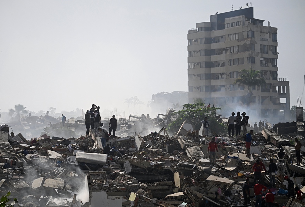
At least 235 people have been confirmed dead so far, 4,300 injured and nearly 50,000 people have been reported missing.
Interim president Delcy Rodriguez declared a state of emergency after the earthquakes caused building collapses in the capital and forced the closure of the nation’s main international airport.
The US Geological Survey said there was a 44 per cent probability that fatalities could exceed 10,000.
Search and rescue efforts have continued through Friday with hundreds expected to still be under the rubble.
La Guaira
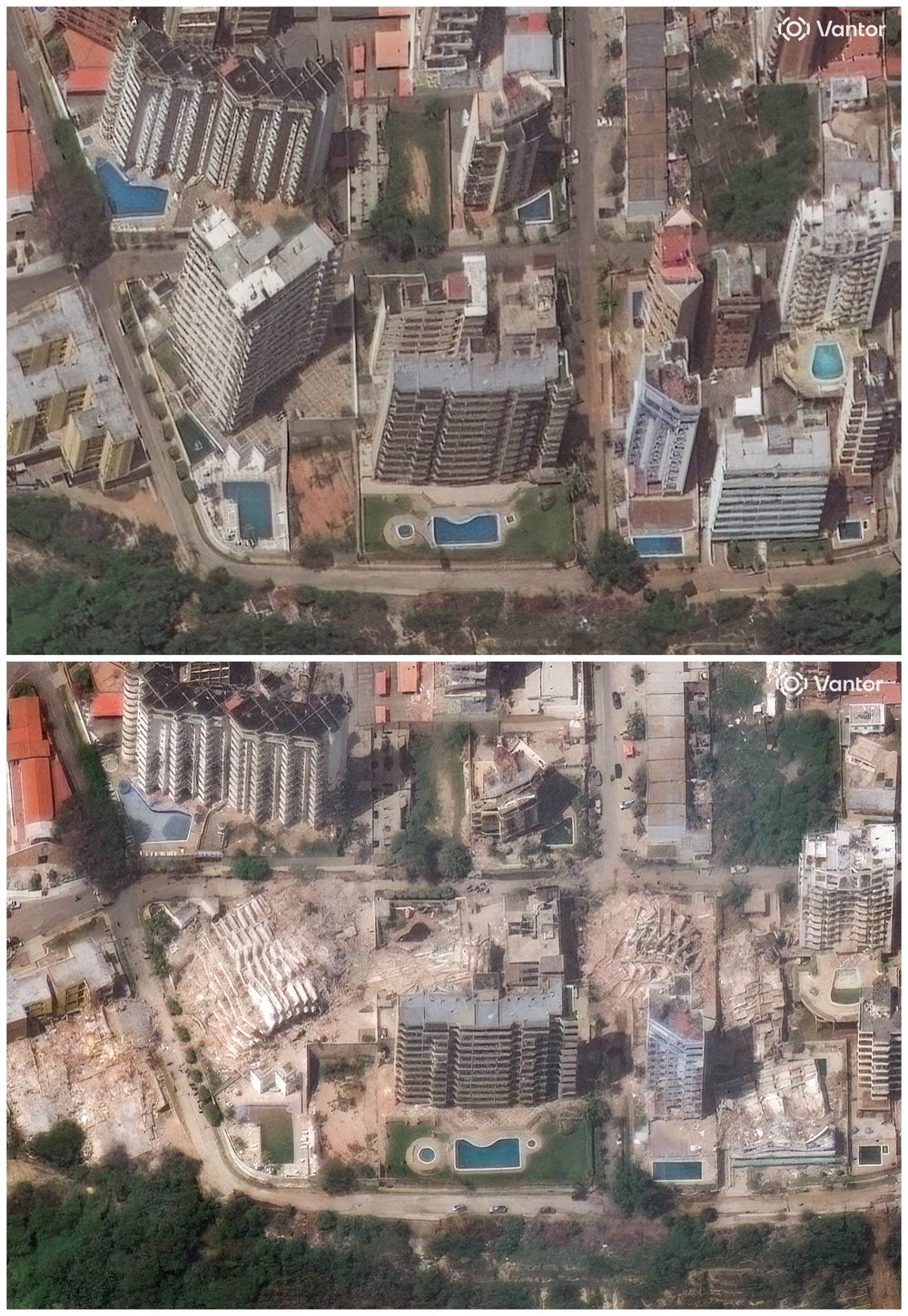
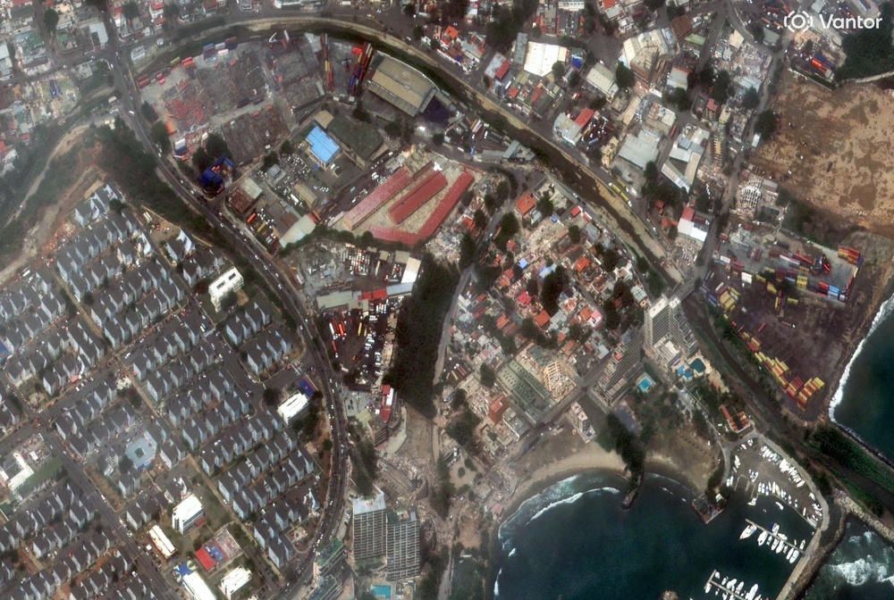
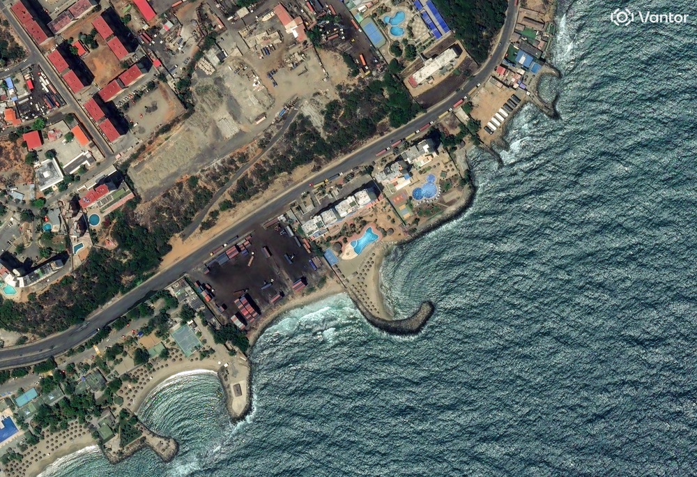
The coastal state of La Guaira appears to have been hardest hit by the devastation with satellite images showing large areas of the region reduced to rubble.
It is located approximately 20 miles or 30km away from the country’s capital Caracas, which was also hit by the quake.
The state airport, located in Maiquetia has suffered severe infrastructure damage and was forced to temporarily close in the aftermath of the tremors.
National Assembly president Jorge Rodríguez said that more than 250 structures have been “damaged or lost” and added that in La Guaira “dozens” of buildings had collapsed.
“We can say that the state of La Guaira is a true tragedy and has become a disaster zone,” he said.
Caracas
Pictures also show severe damage to the country’s capital Caracas, which is home to more than five million people.
The International Federation of the Red Cross reported critical damage to its headquarters in the capital, warning it could affect its ability to operate.
“The Venezuelan Red Cross has been working around the clock — carrying out search and rescue, physical and and psychological first aid, restoring family links and damage assessments — even though its own volunteers are among those affected,” it wrote in a statement on Friday.
“Its National Headquarters has been critically damaged and some volunteers have lost their homes. The Venezuelan Red Cross’ national network of hospitals, clinics and ambulance services is helping to support an overwhelmed health system.”
Several countries across the world have pledged their support with humanitarian aid including the US and the UK.
Spain’s foreign minister José Manuel Albares said that at least two Spaniards had died and that 80 remain missing.
Read MoreVenezuela earthquake latest: Death toll soars to 235 with 50,000 missing
Ex-New York Mets pitcher says he narrowly escaped death in Venezuela earthquake
Venezuelans hope online posts will bring news of missing after devastating earthquakes
NYC set to freeze rents as critics warn of crumbling buildings and bankrupt landlords
Flu outbreak at Texas Air Force base nears 300 cases amid vaccine policy change
Trump caves after holding housing bill hostage over voting fight


