
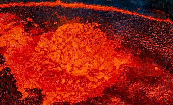
In March 2022, São Jorge Island in the Azores was rattled by thousands of earthquakes, hinting that something unusual was happening deep beneath the surface. Scientists from University College London (UCL) have since revealed that a massive surge of magma was rising from far below, enough to fill 32,000 Olympic-sized swimming pools. For a few tense days, the island appeared to be on the verge of a volcanic eruption.
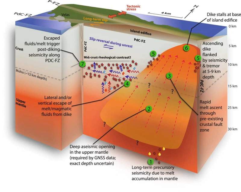
The molten rock moved surprisingly fast, rising from more than 20 kilometers underground. Most of the journey, however, was almost silent, producing very little seismic activity. It wasn’t until the magma reached shallower layers that the earthquakes became frequent, leaving experts questioning just how close São Jorge had come to erupting.
Volcanologists stress that studying these hidden magma surges is crucial to understanding how volcanic islands evolve. While subsurface melt
intrusions don’t always result in eruptions, they play a key role in shaping landforms over time. The study, published in Nature Communications, combined data from seismometers, satellite imagery, and GPS measurements to map the magma’s underground path in unprecedented detail.
A Silent Surge Reshapes The Crust
Dr. Stephen Hicks of UCL Earth Sciences explained that the magma shot up through the crust in just a few days. “Much of its journey was silent,” he added, pointing out how hard it is to predict these kinds of events.
Satellite data revealed that the island’s surface lifted by approximately six centimeters during the intrusion, confirming that magma had entered the shallow crust. Eventually, the molten rock stopped 1.6 kilometers below the surface, creating what scientists refer to as a “failed eruption.”
Unlike a full eruption, a failed one involves molten mass reaching near-surface levels without breaching the crust, leaving only subtle geological signs above ground.
Magma Guided By A Fault System
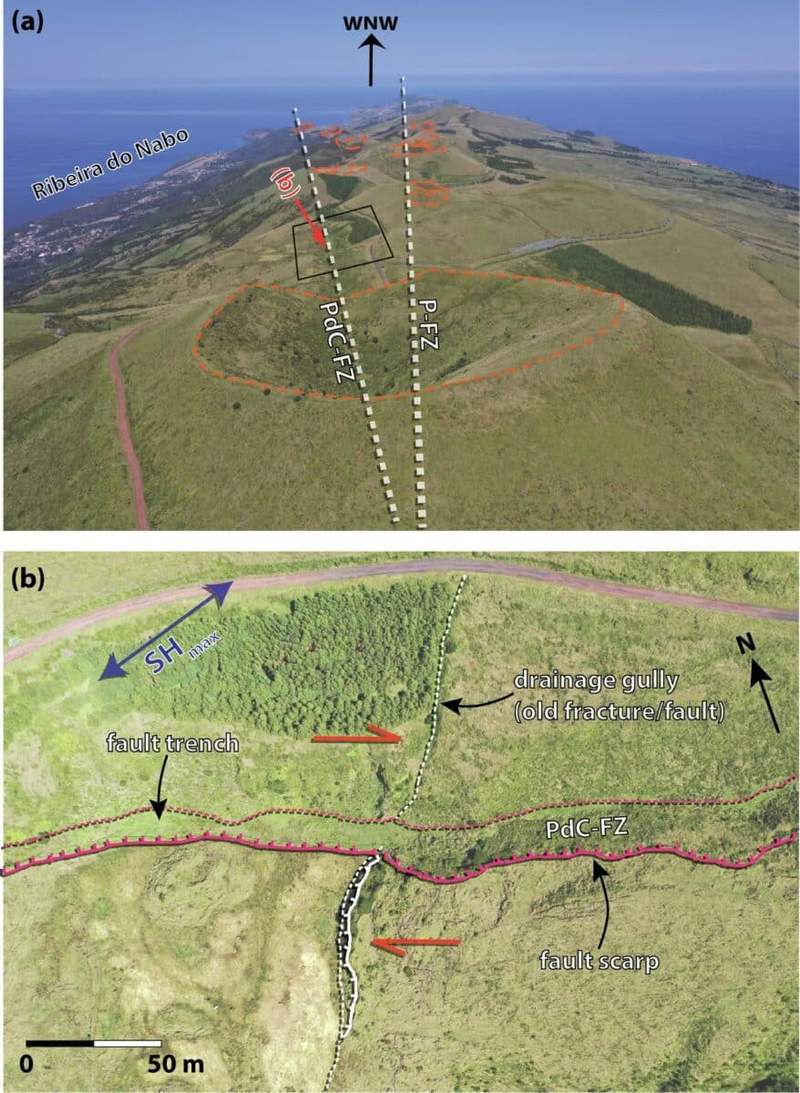
As explained in the study, the Pico do Carvão Fault Zone acted as the primary pathway for the rising volcanic melt. Instead of producing a single major earthquake, the intrusion triggered thousands of smaller tremors along the fault. Dr. Pablo J. González of the Spanish National Research Council said:
“The fault acted like both a highway and a leak. It helped magma rise, but may also have prevented an eruption.”
This venting likely reduced pressure within the magma chamber, preventing the molten rock from reaching the surface and averting an eruption.
The fault’s dual role shows how geological structures can influence volcanic behavior. Along with guiding magma, fault zones may provide escape routes for fluids and gases, effectively acting as pressure-release systems.
Mapping Underground Pathways With Precision
To reconstruct the magma’s path, scientists used seismometers both on the island and across the Atlantic seafloor, alongside GPS and satellite measurements.
“This study supported local authorities in assessing a potential volcanic threat, highlighting the value of combining onshore and offshore geophysical data for accurate detection and localization of seismic events and ground deformation,” noted Dr. Ricardo Ramalho of Cardiff University noted.

The maps gave one of the clearest looks so far at how magma moves under volcanic islands, showing in detail how molten rock interacts with faults and the surrounding crust.
The São Jorge event shows just how fast huge amounts of magma can shift beneath the Earth’s surface with almost no warning. Even though it never erupted, the thousands of earthquakes it caused revealed the hidden forces shaping the island and gave volcanologists around the world valuable data.
Enjoyed this article? Subscribe to our free newsletter for engaging stories, exclusive content, and the latest news.