
The UK’s first named storm of the season is due to hit this week with possible 70mph winds and rain lashing the south of England.
Storm Austen is expected to hit the country late on Thursday as an area of low pressure formed in the Atlantic rapidly deepens over the south west of England and Wales.
The Met Office has issued a yellow weather warning for southern parts of England as well as south Wales on Friday, with the possibility of travel disruption, power cuts and even injuries from debris in places.
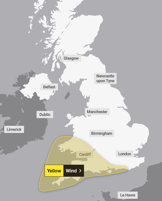
The warning is in place from midnight on Thursday until at least midday on Friday, and covers parts of London and south east England, south west England, Wales, and the west Midlands.
Forecasters warned the storm could cause disruption to public transport, power cuts, and a small chance of injuries and danger to life from flying debris. People have been urged to check road conditions in advance and consider preparing for a power cut if they are in the affected area.
Deputy chief forecaster Tom Crabtree said the exact path of the storm is still being determined, but it is “clear” that Storm Austen will be an “impactful period of weather,” with gusts reaching up to 70mph in the most exposed coastal areas.
Elsewhere, wind speeds reaching 50-60mph are widely expected in the south of England and Wales.
“While the exact track and position of Storm Austen is still being determined, what’s clear is that we have an impactful period of weather on the way and the potential for disruption in places, which has resulted in the system being named,” he said.
“Peak gusts in excess of 70mph are possible on the most exposed coastal areas, while 50-60mph are likely more widely within the warning area. Weather warnings are under constant review and could be updated as confidence increases, so it’s important to stay up-to-date with the forecast in the coming days.”
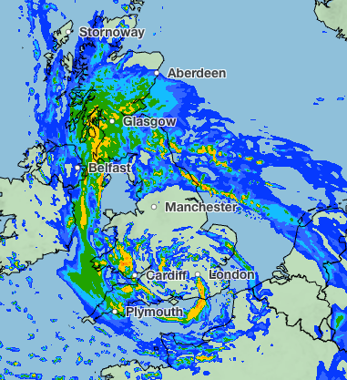
Storm Austen will move from west to east through Friday, with winds generally dying down later in the day. Rain is also forecast, with 20-30mm in many places and higher totals possible over higher ground in the west and further north on Friday.
“There will be some periods of heavy rain which will make travel more difficult,” forecasters said. “Whilst it will remain breezy the winds will probably ease late morning into the early afternoon.”
Met Office five-day forecast
Tuesday:
Cloudy in the east with outbreaks of rain, while western areas start dry with sunny spells. Rain drifts west then retreats east later. Further rain, heavy in places, spreads from the west. Winds strengthen later.
Wednesday:
Rain continues to push across Scotland, turning heavy at times. Elsewhere, showers and squally rain move east, heavy and possibly thundery near southern and southwestern coasts. Windy across the south.
Outlook for Thursday to Saturday:
Unsettled with showers and longer spells of rain. Strong winds likely as low pressure crosses southern UK Thursday and Friday. Temperatures near or below normal, with wind warnings in force.
Read MoreMet Office explains why the UK felt so cold this weekend and when it will get warmer
Heavy rain and gales to batter UK as Met Office issue yellow weather warning