Thailand develops climate data and risk maps to prepare for El Nino expected to persist through early 2027, says ministry.
BANGKOK: Thailand is developing high-resolution climate data and risk-mapping tools to prepare for the El Nino weather pattern that global agencies expect to persist through early 2027, the Ministry of Natural Resources and Environment said on Tuesday, reported Xinhua.
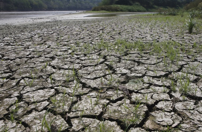
Citing data from international climate organisations, the ministry said the world is almost certain to enter El Niño conditions in June-July, with the intensity expected to peak between November 2026 and January 2027.
Phirun Saiyasitpanich, director-general of the Department of Climate Change and Environment, said rainfall across many parts of Thailand would be below normal from June 2026 to January 2027 and that the wet season could see less rain if the phenomenon strengthens.
The southern region is expected to face reduced rainfall in December and January, while average temperatures nationwide are expected to run slightly above normal, likely making the coming winter milder than usual, Phirun said in a statement.
In response, the department said it has developed climate projections through the year 2100, covering rainfall, temperatures and humidity, with the Climate Change Information Centre sharing the data with agencies for long-term flood and drought planning.
The department is also working on a high-resolution river flood-risk dataset and a subdistrict-level climate risk map covering floods, droughts, landslides, sea-level rise and rising temperatures, the official noted.
He added that the risk map will help pinpoint vulnerable communities and farmland, guide budget and manpower allocation, support farmers in adjusting planting calendars and crop choices, and inform urban planning to avoid building critical infrastructure in hazard-prone areas.