The third heatwave of the year will hit the UK this weekend with temperatures set to climb to 34C in the coming days.
A week-long warning from health officials came into force at midday in parts of the UK, with the Met Office warning that high temperatures later in the week could cause a greater risk to life for vulnerable people.
Forecasters say temperatures in the south could reach 29C on Sunday, before approaching approach the low 30s next week and hitting a peak of 34C on Thursday or Friday.
But, while the country was left reeling after June’s record-breaking heatwave, the next hot spell is promised to be much more pleasant as humidity levels will remain low.
The heatwave will also not affect the whole of the UK, with mainly the south and south east of England affected.
Aidan McGivern, Met Office meteorologist, said: “It’s not going to be as hot or as humid so not quite as uncomfortable, and not quite as impactful. It also will not affect the whole of UK.”
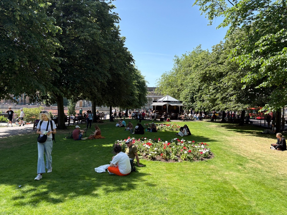
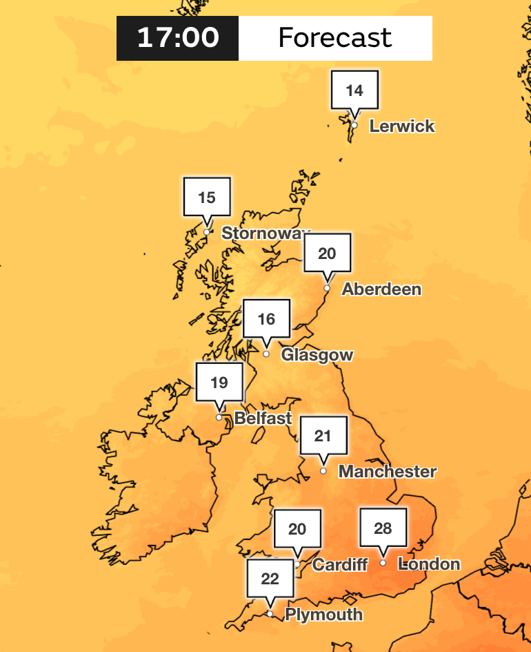
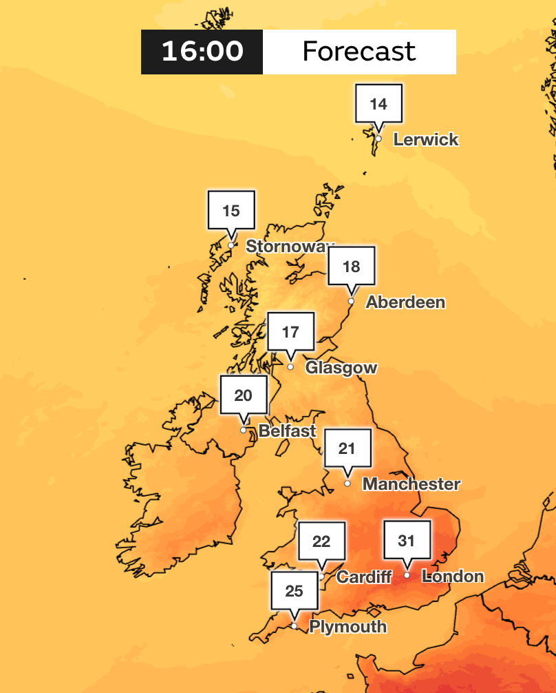
On Saturday, highs of 28C are expected in the southeast of England, as temperatures in the south all stay above 20C.
Further north, temperatures hang around the high teens, and as we get to Scotland, there is only a slight dip in temperature as the mercury remains in the mid-teens, around 16-17C.
Sunday will be the hotter day this weekend, with highs of 29C expected in London. The heat will continue to build into next week as Monday could see highs of 31C.
Yellow heat health alerts have been issued by the UK Health Security Agency (UKHSA), covering the East Midlands, east, south-east and south-west of England, including London, and the West Midlands, from midday on Saturday until 8pm on July 11.
While the south will bask in the sunny weather this weekend, western Scotland is set to have a very wet spell, especially over the west and northwest Highlands where there is the risk of over 100mm of rain by the end of this weekend, Mr McGivern said.
More pulses of wet weather will be seen across large swathes of the northwest on Sunday morning, with widespread rain across Scotland into parts of northern England, the Pennines, the Lake District and some outbreaks in Northern Ireland.
The significant contrasts from place to place is due to an “emerging area of high pressure extending over the Azores sitting close to the south and southwest over the weekend,” the Met Office meteorologist said.
He added: “A westerly airflow over the top of that high brings frontal systems into Scotland, and those fronts will ebb and flow. They will bring a lot of cloud, a strong breeze and outbreaks of heavy and persistent rain.”
Meanwhile, Southern Water has issued a hosepipe pan from 12.01am on July 10 in Hampshire and on the Isle of Wight.
Southern Water says on its website that “the warmest spring on record, followed by a record-breaking heatwave, has left river levels 25% lower than expected for this time of year”.
It adds that the River Test has lost a third of its water within the last month, “putting pressure on our ability to treat and supply your water”.
Southern Water says the hosepipe ban will be removed “as soon as we can”, adding “this can only happen when there’s enough water in our reservoirs, rivers and underground aquifers to meet demand”.
South East Water’s temporary hosepipe ban for people living in Kent came into force on Friday.
Met Office forecast
Today:
A rather cloudy start, with outbreaks of rain in the north and west. Brightening up for many, with spells of warm sunshine developing. Though staying cloudy across the northwest, with further rain in places. Locally hot in the southeast.
Tonight:
Cloud and patchy rain across parts of Scotland, Northern Ireland and northern England. Largely dry elsewhere, with clear spells and perhaps the odd light showers. A mild night for most.
Sunday:
Warm spells of sunshine for much of England and Wales. Cloudier across Northern Ireland and Scotland, with further rain here. Staying hot towards the southeast, generally warm elsewhere.
Outlook for Monday to Wednesday:
Further spells of rain across northwestern parts through Monday and Tuesday. Temperatures near average here. Staying sunny elsewhere and turning locally hot in the southeast. Widely dry and warm Wednesday.
Read MoreMapped: Where temperatures will hit 31C in scorching July heatwave
Hosepipe ban map: Where restrictions are in place ahead of another UK heatwave
Next UK heatwave could last 10 days with temperatures to rise this weekend
New heat health alert issued as another UK heatwave approaches
Sewage spills into bathing ponds during heatwave
Heatwave ends as Met Office removes extreme heat warnings and forecasts rain