
For long-term resilience, specialists argue that urban planning must be inextricably linked with water management.
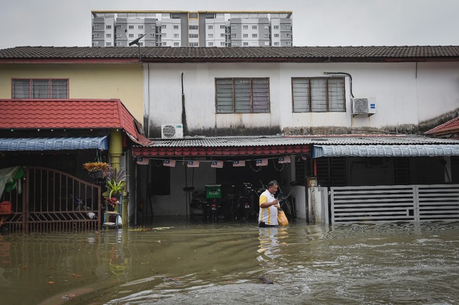
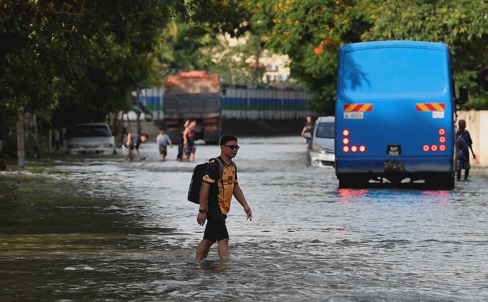
PETALING JAYA: Despite decades of substantial investment in flood mitigation, Kuala Lumpur and Selangor remain chronically vulnerable to severe inundation.
Experts told Sinar Daily that a widening gap between outdated drainage infrastructure and volatile weather pattern driven by climate change is the primary catalyst for the region’s ongoing struggle.
For long-term resilience, specialists argue that urban planning must be inextricably linked with water management, moving beyond traditional concrete drains toward climate-adaptive “Sponge City” concepts.
The mismatch: 1980s design vs 2020s rain
Former Malaysian Water Partnership chairman Datuk Ir Nor Hisham Mohd Ghazali observed that the Klang Valley’s existing drainage systems were built for a different era. Most infrastructure was designed based on rainfall data from the 1970s and 1980s, which is no longer sufficient for modern conditions.
“Flooding is largely the result of infrastructure being overwhelmed by the volume of runoff produced by high-intensity rainfall,” Hisham told Sinar Daily. He stated that while climate change has brought longer dry spells, it has also increased the frequency of short-duration, heavy downpours that exceed the “design thresholds” of current drains.
Successes and limits of mitigation
Since the 1980s, the Kuala Lumpur Flood Mitigation (KLFM) programme has seen the deepening of key rivers—including the Klang, Gombak and Batu—and the construction of the Batu Dam and various diversion ponds. Combined with the SMART Tunnel, these measures have successfully averted at least five catastrophic flood events, particularly those triggered by seasonal monsoons.
However, Hisham cautioned that “flash floods” are a different beast. Their localised and rapid development makes them nearly impossible to eliminate entirely.
He explained that the Urban Stormwater Management Manual has introduced a “control at source” approach, requiring new developments to incorporate features such as detention ponds and green spaces to temporarily store runoff before it is released into rivers.
He also highlighted that ongoing rapid urbanisation continues to increase the risk and intensity of flash floods.
“Rapid urbanisation and land use change continue to intensify flood risks. Large-scale paving reduces natural absorption areas, while construction activities can temporarily worsen drainage conditions.
“Coordination challenges across different levels of government also affect flood management effectiveness. Flood prevention infrastructure is designed for specific risk levels; when events exceed those levels, the system can only reduce impact, not fully prevent flooding,” he said.
Hisham said that despite existing constraints, the Klang Valley continues to show relatively strong resilience to flooding. He stated that, compared to many global cities, the region is still able to function even after rainfall events of about 60 to 70 millimetres over a three-hour period.
The “cloudburst” phenomenon
In a related matter, water engineering expert from Universiti Putra Malaysia, Associate Professor Dr Syazwani Idrus, highlighted that Malaysia’s rainfall has become increasingly “volatile.”
Predicted monsoon patterns are being replaced by sudden cloudbursts.
“In many instances, over 60mm of rain falls in just two hours,” she said. This becomes particularly dangerous in low-lying areas like Sri Muda, where heavy rain often coincides with high tides in the Klang River, causing water to flow backwards into residential zones.
Innovation: Digital twins and sponge cities
To combat these challenges, Malaysia is beginning to pivot toward advanced technology and holistic urban design:
- Digital Twin Technology: These systems are being used to simulate and predict flood levels up to six hours in advance.
- Dredging and Upgrades: Continuous desilting of the Klang River is necessary as sediment and waste buildup frequently reduce its carrying capacity.
- The Sponge City Concept: Following the lead of cities like Rotterdam, Singapore, and Copenhagen, Malaysia is exploring multifunctional urban spaces that act as temporary reservoirs rather than relying solely on rapid discharge.
The path forward
While the Klang Valley remains relatively resilient—still functioning after 70mm of rain over three hours—experts agree that conventional engineering has reached its limit. The future of the region depends on interconnected pond systems and targeted solutions at known hotspots, ensuring that as the climate changes, our cities change with it.