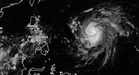
MANILA, Philippines — "Champi" re-intensified into a super typhoon, said the Philippine Atmospheric, Geophysical and Astronomical Services Administration (Pagasa).
It said on Facebook that "Champi" had re-intensified into a super typhoon as of 2 p.m. on Monday.
In the tropical cyclone advisory issued at 5 p.m., it said that the super typhoon "will continue moving west northwestward until it enters the Philippine Area of Responsibility (PAR) tomorrow (20 October) morning or early afternoon."
Based on the advisory, the center of the eye of "Champi" was about 1,515 kilometers east of southeastern Luzon as of 4 p.m.
Also based on the advisory, it was moving west northwestward at 15 kilometers per hour (km/h) with maximum sustained winds of 185 km/h near the center and gustiness reaching 230 km/h.
Weather Specialist Charmagne Varilla said in Filipino and English in the 5 p.m. weather update that based on Pagasa's latest forecast track, "from what we see," "Champi" could enter the PAR on Tuesday morning or afternoon.
It will be called Rosal while inside the PAR.
Rosal "will remain a super typhoon while traversing the eastern part of the seas of northern Luzon," Varilla said.
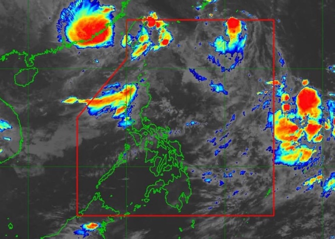
Also during the weather update, she said that the super typhoon's trough was bringing moderate to occasionally heavy rains to the eastern part of southern Luzon and Visayas.
"Meanwhile, the effect of our easterlies here in parts of extreme northern Luzon continues" Varilla said. The easterlies were bringing isolated rainshowers and thunderstorms, she said.
Based on Pagasa's forecast Tuesday weather condition, the trough was expected to continue affecting parts of Catanduanes, Northern Samar, and Eastern Samar.
Varilla said easterlies' effect in parts of the Ilocos Region, Cordillera, and Cagayan Valley would be good Tuesday weather. "However, prepare for isolated rain showers and thunderstorms most especially at night," she said.
As to the rest of Luzon including Metro Manila, Varilla said that good weather would continue on Tuesday but told the public to "also expect sudden rain most especially in the afternoon."
The Intertropical Convergence Zone would continue to bring moderate to occasionally heavy rains on Tuesday in Palawan and the Zamboanga Peninsula, she said.
"In the rest of the Visayas and Mindanao, let us expect better weather but let us expect localized thunderstorms by afternoon or evening," she said.