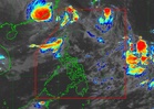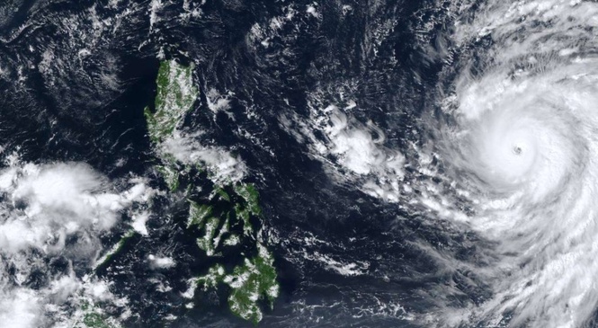
MANILA, Philippines —Typhoon Champi maintained its strength as it continued to approach the Philippine Area of Responsibility (PAR) on Monday.
In the tropical cyclone advisory issued today at 11 a.m., the Philippine Atmospheric, Geophysical and Astronomical Services Administration (Pagasa) said the center of the the typhoon's eye was about 1,600 kilometers east of southeastern Luzon.
Based on the advisory, it was moving west northwestward at 20 kilometers per hour (km/h) with maximum sustained winds of 175 km/h near the center and gustiness reaching 215 km/h.
"Strong to typhoon-force winds extend outwards up to 720 km from the center," Pagasa said.
"Champi" will be called Rosal when it enters the PAR.
It "will continue moving west northwestward until it enters the" PAR "tomorrow morning or early afternoon" and "will remain over the Philippine Sea as it moves towards Taiwan," Pagasa said.
"Champi" had weakened into a being a typhoon from being a super typhoon but Pagasa said it "is forecast to re-intensify beginning this evening and may again reach super typhoon category."
"Further intensification remains possible while it moves over the Philippine Sea. A gradual weakening trend is likely to begin by Wednesday (21 October) after it reaches peak intensity," said the state weather bureau.
"Wind Signals may be hoisted over the northern and eastern portions of Northern Luzon and portions of Bicol Region as early as this evening or tomorrow morning in anticipation of strong winds or higher...The highest Wind Signal for the current forecast scenario is Wind Signal No..3 or 4," it said.
Pagasa also said that "Champi" would "bring heavy rains to" extreme north Luzon.
"Gusty conditions over most parts of Luzon and Visayas and portions of Mindanao are likely to begin by Wednesday," it said.
"Moderate to rough seas may begin over the northern and eastern seaboards of Visayas and Mindanao by tomorrow. Hazardous sea conditions (reaching very rough, high, or very high seas) may affect the northern and eastern seaboards of Luzon by Wednesday onwards," it said.