Even as the southwest monsoon has revived over parts of central India after remaining stalled for nearly two weeks, Chandigarh, Punjab and Haryana continue to wait for its arrival, with meteorologists indicating that the monsoon is likely to reach the region only towards the end of June, making it later than normal this year.
Weather experts attribute the delay to the prolonged stagnation in the monsoon’s northward advance after an initially rapid onset.
According to meteorologists, persistent western disturbances over north India and the temporary weakening of monsoon currents prevented the system from advancing into northwest India on schedule.
The monsoon, which normally reaches Punjab, Haryana and Chandigarh around the last week of June, is now expected around month-end after losing momentum during the second week of June.
The delayed monsoon has meant that despite heavy rain episodes in Delhi-NCR, Himachal Pradesh and several other parts of northern India in recent days, Punjab and Haryana have largely remained dependent on isolated pre-monsoon thunderstorms for relief from the heat.
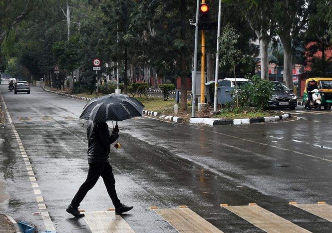
One such thunderstorm swept across parts of Chandigarh Tricity on Sunday night, bringing 5.1 mm rainfall to Chandigarh and triggering a sharp fall in both day and night temperatures on Monday.
According to the India Meteorological Department (IMD), Chandigarh recorded 5.1 mm rainfall, making it the third-highest 24-hour rainfall station in the Punjab-Haryana region, behind Yamunanagar (7.5 mm) and Amritsar (6.7 mm).
Other stations reported only light rainfall or traces. The storm also led to temporary disruptions in power supply in several parts of Chandigarh, Mohali and Panchkula, with reports of snapped tree branches and localised damage to electricity infrastructure.
The cooling impact was immediately reflected in temperature readings. Chandigarh’s maximum temperature plunged to 35°C, a sharp fall of 4.8 degrees Celsius from the previous day and 2.5 degrees below normal.
The minimum temperature dropped to 22.4°C, down 2.6 degrees Celsius and 5.2 degrees below normal. IMD data showed Chandigarh recorded the coolest night in Punjab and the second coolest in Haryana after Bhiwani, which reported a minimum of 21.5°C.
Interestingly, weather conditions varied sharply within the Tricity itself.
While Chandigarh experienced one of the coolest nights in the region, Mohali recorded a minimum temperature of 26.5°C, making it the second warmest night in Punjab after Bathinda’s 27.3°C.
Yet during the day, Mohali emerged as one of the coolest places in the state, recording a maximum temperature of 34°C, second only to Nawanshahr (31.8°C). In fact, Mohali’s maximum temperature was lower than every reporting station in Haryana on Monday.
Across Punjab, average maximum temperatures fell by 3.6 degrees Celsius and remained 2.3 degrees below normal, while average minimum temperatures declined by 1.5 degrees Celsius and stayed 1.7 degrees below normal.
Haryana also witnessed a substantial cooling trend, with average maximum and minimum temperatures dropping by 2.4 degrees Celsius and 1.7 degrees Celsius, respectively.
Despite the relief, the respite may prove temporary.
IMD extends yellow alert till Friday
The IMD has extended the yellow alert for thunderstorms, lightning and gusty winds of 40-50 kmph at isolated places till Friday across Chandigarh, Punjab and Haryana. Scattered showers are likely at isolated locations during this period.
However, the weather office has forecast dry conditions for Saturday and Sunday, with no warning or alert in place for the weekend.
For the Tricity, the forecast suggests a gradual rise in temperatures from Tuesday onwards. Maximum temperatures are expected to remain around 38°C throughout the week, while minimum temperatures are likely to climb from 24°C on Tuesday to 27°C from Thursday onwards. Partly cloudy skies are expected to persist, but widespread rainfall is not indicated.
A senior meteorologist said the region is currently witnessing a transition phase between pre-monsoon thunderstorms and the eventual arrival of the southwest monsoon.
“The thunderstorm activity being witnessed over Chandigarh, Punjab and Haryana is pre-monsoon in nature and should not be confused with monsoon onset. The southwest monsoon’s advance slowed considerably during the past two weeks because of unfavourable large-scale atmospheric conditions and repeated western disturbances over north India. While isolated thunderstorms and showers will continue to occur, a sustained wet spell associated with monsoon arrival is more likely towards the end of June. Until then, temperatures are expected to rise again after the temporary cooling caused by Sunday’s storm,” the meteorologist said.
For residents of Chandigarh, Mohali and Panchkula, the outlook remains familiar: occasional thunderstorms, brief spells of relief and rising temperatures in between, while the region waits for the southwest monsoon to finally arrive and deliver the sustained rainfall that has so far remained elusive this season.