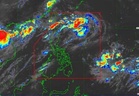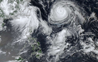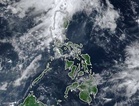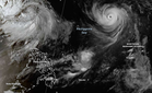
MANILA, Philippines — Typhoon Obet is now outside the Philippine Area of Responsibility (PAR).
The Philippine Atmospheric, Geophysical and Astronomical Services Administration (Pagasa) said "Obet" has exited the PAR as of 9:30 p.m. on Monday.
"It will continue moving generally west northwestward and pass close or make landfall over the southern islands of Japan between tomorrow (25 August) and Wednesday (26 August) before moving generally westward and making landfall over the southeastern coast of mainland China by Friday (28 August)," Pagasa said in the Tropical Cyclone Bulletin it issued at 11 p.m.
"Obet is forecast to steadily weaken while moving over the area of the southern islands of Japan and north of Taiwan. After Obet makes landfall over the southeastern coast of mainland China and moves further inland, it will weaken into a severe tropical storm by Friday and into a tropical depression by Saturday (29 August)," it said.
"Unless re-entry occurs, this is the final bulletin for this weather disturbance," it said.
Based on this bulletin, the center of the eye of "Obet" (international name: Saudel) was about 1,250 kilometers east northeast of extreme northern Luzon as of 10 p.m.
It was moving west northwestward with maximum sustained winds of 155 kilometers per hour (km/h) near the center and gustiness reaching 190 km/h, Pagasa said.
"Strong to typhoon-force winds extend outwards up to 540 km from the center," it said.
"Obet" exited the PAR about eight hours after entry at 1:20 p.m.
Pagasa forecasted up to rough seas over the following coastal waters and advised those using small vessels "to take precautionary measures while venturing out to sea and, if possible, avoid navigation under these conditions:"
- Up to 3.5 meters: The seaboards of Batanes; and Babuyan Islands' northern seaboard
- Up to 3 meters: Babuyan Islands' western seaboards; Ilocos Norte's northern seaboard; and Kalayaan Islands' northern and western seaboards
Pagasa gave the same advice as it forecasted up to moderate seas over these coastal waters:
- Up to 2.5 meters: "The seaboards of Ilocos Sur, mainland Cagayan, Isabela, Zambales, northern Aurora, and Surigao del Sur; the western seaboards of Pangasinan, Bataan, and Lubang Islands; the eastern seaboard of Davao Oriental; the remaining seaboards of Babuyan Islands, Ilocos Norte, and Kalayaan Islands."
- Up to 2 meters: "The seaboards of La Union, Davao del Sur, and Davao Occidental; the western seaboards of Cavite, Batangas, Occidental Mindoro, and mainland Palawan including Calamian Islands; the northern and eastern seaboards of Camarines Norte and Camarines Sur; the eastern seaboards of northern Quezon, Albay, Sorsogon, Eastern Samar, and the Siargao-Bucas Grande Islands; the remaining seaboards of Pangasinan, and Lubang Islands."
Pagasa forecasted wave heights below 2 meters for other coastal waters.