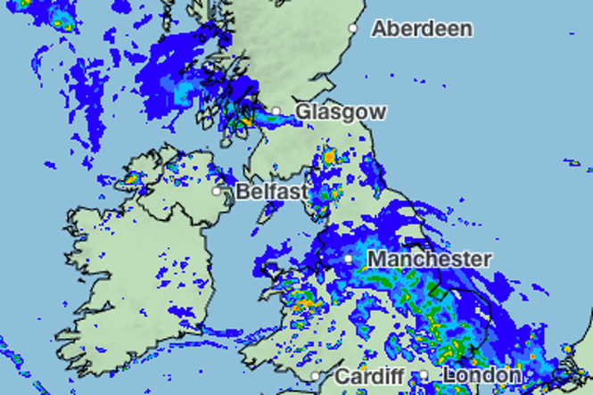
Bank Holiday weekend could be a wash-out as heavy rain and showers are forecast across the UK.
Following what was one of the driest summers to date, several days of rain and strong winds are forecast for the long weekend.
Rain is set to arrive on Friday evening in London, with heavier downpours forecast in Wales, the north of England and Scotland throughout the day.
The weekend will get off to a soggy start as rain sweeps across Cornwall and Devon on Saturday morning moving north bringing heavy downpours in the north of England and London.
Despite the rain temperatures are forecast to stay in the low 20C across England and Wales, while Edinburgh is forecast to see sunny intervals and temperatures hitting 19C.
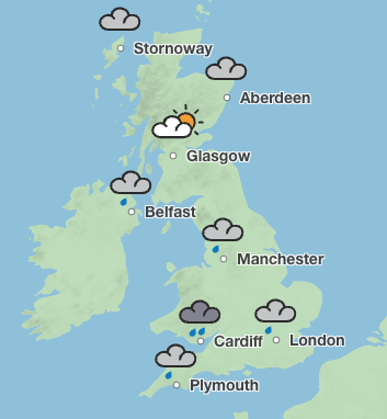
The Met Office has forecast up to 95 per cent rain coverage in London, Manchester and Cardiff on Saturday.
Sunday will remain unsettled with more heavy showers and possible thunderstorms.
London is expected to see light rain in the early afternoon, while Manchester and Cardiff could see heavy rain for most of the day.
But the weather is set to brighten up with sunny interludes on Monday in London, with a few showers in the afternoon. According to the Met Office, the capital and parts of the South will enjoy highs of 22C and sunshine.
Cardiff could also see a sunnier afternoon on Monday after downpours in the morning, with more rain forecast in Manchester and Scotland.
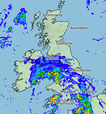
Forecast for the next five days
Friday:
Heavy rain will affect parts of Scotland and northern England at times. Elsewhere, showers will become increasingly widespread, locally heavy with isolated thunder, alongside sunny spells. Breezy, with strong winds possible near some coasts. Temperatures near average.
Friday night:
Any remaining shower will ease overnight leaving patch cloud and clearer spells. Rain moving into the southwest later and winds increase. Staying warm for many overnight.
Saturday:
Occasionally heavy rain moves east across England and Wales. Brighter conditions follow in the south with heavy, possibly thundery showers. Rain moves north, but stays mostly dry for Scotland.
Outlook for Sunday to Tuesday:
Sunshine and showers for Sunday, some heavy and thundery, with rain moving east later. Monday sees drier conditions developing southwards, though further rain possible. Tuesday brings sunny spells, scattered showers.
Read MorePeople urged to prepare ‘emergency kit’ as Met Office warns of floods and storms
Large parts of UK under thunderstorm and flood warnings today – full list of regions
Mapped: Where thunderstorms and 75mm of rain could hit UK this week
UK weather forecast: Will there be another heatwave in September?
Italy and Spain hit by floods and heavy rain weeks after 40C heatwave and wildfires
Met Office issues multiple thunderstorm warnings as flooding fears rise