.png)
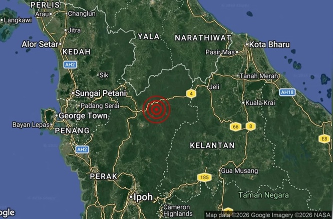
RESIDENTS in and around Gerik in Perak have been advised not to panic following a weak 3.4-magnitude earthquake detected in the Temenggor area shortly after midnight.
Perak Science, Environment and Green Technology Committee chairman Teh Kok Lim said similar incidents had previously been recorded in Temenggor in 2013 and 2016, and in Manjung in 2009.
He said the incidents prompted the Department of Minerals and Geoscience (JMG) to conduct an Active Fault Project to gather information on fault structures that could potentially trigger tremors and seismic activity.
“The project was carried out based on satellite imagery, Landsat data and field studies to identify active fault structures in the state.
“In general, the risk of earthquakes occurring in Perak is low despite the presence of fault structures in several areas.
“Even if an earthquake were to occur, its magnitude is expected to be low to moderate,” he said in Ipoh today.
Teh said the first phase of the Active Fault Project was carried out in 2016, involving the collection of spatial data to identify potentially active faults in the Temenggor and Manjung areas.
He said the presence of faults was determined through the interpretation of satellite imagery, radar and contour maps, as well as data on earthquake epicentres provided by the Malaysian Meteorological Department (MetMalaysia).
The potentially active faults were subsequently classified into three categories: point sources, line sources and area sources.
“Based on the study findings, the potentially active faults in the Temenggor area comprise line and point sources. The line source in the Temenggor area is essentially designated as the Banding Fault, which is divided into nine segments, with segments two to seven located within the study area,” he said.
Teh said each segment was between 2.9km and 6.6km long and had the potential to generate earthquakes measuring between 3.0 and 4.1 on the moment magnitude scale (Mw).
He said earthquakes in the area were shallow, with the maximum potential magnitude of 4.1 Mw recorded at a depth of 1.6km, while the minimum magnitude of 3.0 Mw was recorded at a depth of 15.3km.
“For the point source in Temenggor, it is located near the Bersia Dam, with the potential to generate an earthquake measuring 2.8 Mw at a depth of 10km,” he said. - August 28, 2026