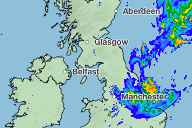
Thunderstorms and heavy rain are expected across the UK this week as a wet and unsettled put an end to a hot and dry summer.
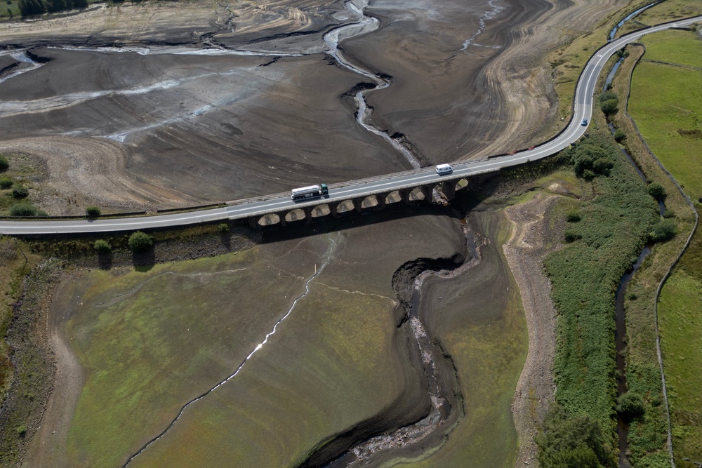
Five back-to-back heatwaves over the past few months has left 70 per cent of England and Wales in a drought. Although some parts of the UK have seen cooler weather and showers, a lot more rain is needed before these conditions start to ease.
However, showery conditions could return by Tuesday, with thunderstorm warnings issued across England and Wales on Wednesday and Thursday
Despite the wet weather, temperatures are predicted to be on the rise, as warmer air moved in pushing temperatures to 26C.
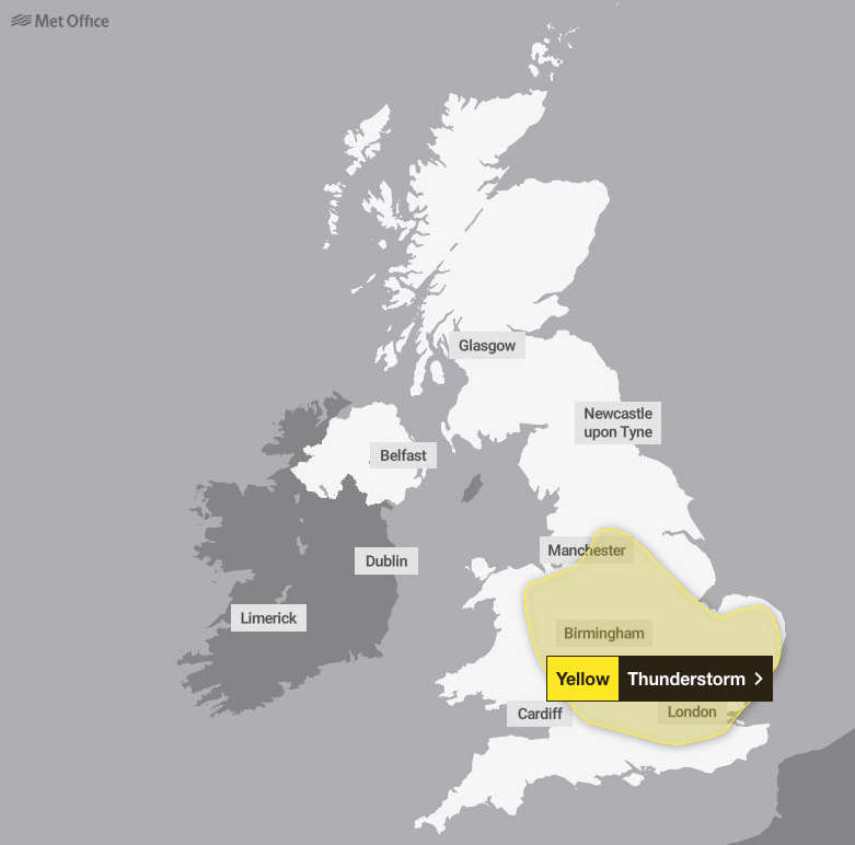
Where will there be thunderstorms?
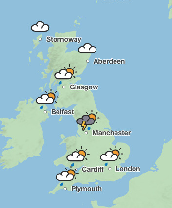
Yellow thunderstorm warnings are in place on Wednesday and Thursday across the West and East Midlands, as well as the North West, South East, South West and east of England, and parts of Wales. The Met Office has warned that lighting and hail could be widespread as the storms move northwards across both days.
Rain is expected to arrive in the south west and south Wales on Tuesday, before more showers sweep across the south of England on Wednesday.
By Thursday, heavy downpours are predicted in the West Midlands before moving up towards Manchester and Leeds.
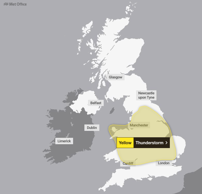
Heavy rain is also forecast on Thursday night in the East of England.
However, thunderstorms could hit Manchester and Newcastle later in the week on Sunday afternoon.
Will there be another heatwave?
Although warm and hot spells are still possible, they will likely be short lived, with temperatures sitting near average.
Temperatures are set to reach 26C in London on Thursday and sit in the mid to low 20C for most of the UK over the week.
But towards the end of September, the Met Office suggests there could be hot spells in the South of England.
2026 is the first year on record to see three separate days where temperatures reached the 37C threshold, as well as the first year with four days at 36C or above.
Before 2026, the UK had recorded 37C or higher on only six occasions.
It also extends 2026’s record-breaking run of days above 35C.
For four months in a row temperatures hit 35C in the UK on at least one day in May, June, July and now August.
July was also the driest month since records began in 1836 in both England and Wales, southern England alone had its driest calendar month ever on record.
By 15 July this year, the UK had already recorded more days above 30C than in the whole of 1976, which was known for its long-lasting heatwave.
What is the long range forecast?
By Bank Holiday weekend showers and longer spells of rain are expected to hit many parts of the UK, along with some strong winds, the Met Office said.
It added that thunderstorms and heavy bursts of rain are also forecast.
The weather is set to remain changeable through the first week of September, with above average rainfall amounts for the time of year.
But some drier and more settled interludes and short-lived warm or hot spells possible in the South of England.
Towards the end of September drier weather could become more prevalent, especially in the south and south east. In the north east more unsettled weather is forecast.
The Met Office said temperatures will probably be near normal at first but may become warmer later, with the possibility of some hot spells in the south.
Met Office thunderstorm warning issued across large parts of UK
Burnham challenges Putin on first trip to Ukraine as UK-Russia tensions grow
Burnham says UK in ‘challenging position’ as he declines to rule out tax rises
Man dies and woman critically injured in crash after police chase
Parents give health update on boy who was thrown into crocodile enclosure