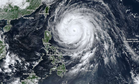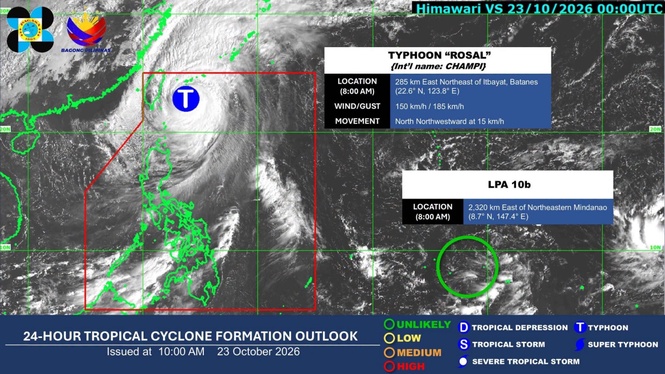
MANILA, Philippines — Typhoon "Rosal" slightly weakened while moving north-northwestward over the sea east of Taiwan, but Signal No. 2 remained over Batanes and the northeastern portion of the Babuyan Islands, the state weather bureau said Friday.
In its 11 a.m. bulletin, the Philippine Atmospheric, Geophysical and Astronomical Services Administration (Pagasa) said that Rosal was located 305 kilometers northeast of Itbayat, Batanes, at 10 a.m. It was moving north-northwestward at 15 kilometers per hour (kph).
Rosal had maximum sustained winds of 150 kph near the center, gusts of up to 185 kph and a central pressure of 955 hectopascals.
Signal No. 2, which warns of gale-force winds of 62 to 88 kph, was raised over Batanes and the northeastern portion of the Babuyan Islands.
Signal no. 1, warning of strong winds of 39 to 61 kph, remained in effect over the rest of the Babuyan Islands, mainland Cagayan, Ilocos Norte and Apayao.
Pagasa said that strong to gale-force gusts were expected today over most of Luzon and the Visayas, as well as Zamboanga del Norte, Misamis Occidental, Lanao del Norte, Camiguin, Davao Occidental and Davao Oriental, particularly in coastal and upland areas exposed to winds.
The. weather bureau said Rosal would continue moving generally northwestward until Friday night before turning northward and then north-northeastward between Saturday and Sunday.
The typhoon was expected to exit the Philippine Area of Responsibility by Saturday morning.
The next tropical cyclone bulletin will be issued at 5 p.m.