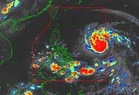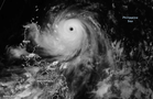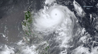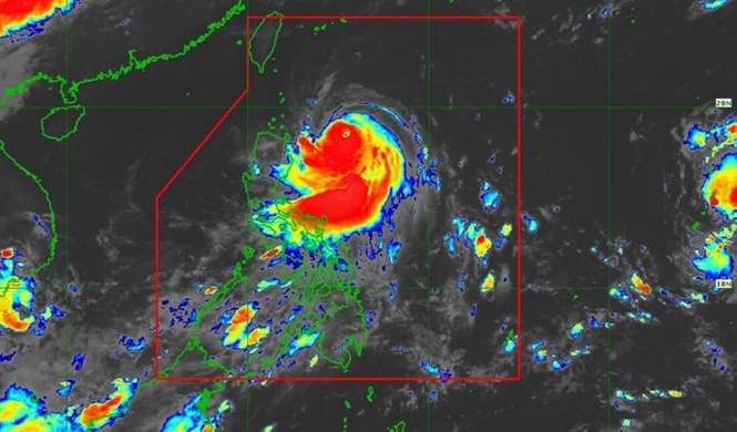
MANILA, Philippines – Tropical Cyclone Francisco has intensified into a super typhoon far away from the Luzon landmass, with Wind Signal 1 up over Batanes and the northern portion of Cagayan, the state-run weather agency said on Tuesday.
Weather specialist Veronica Torres of the Philippine Atmospheric, Geophysical and Astronomical Services Administration (Pagasa) said it is also closely monitoring another weather disturbance outside the Philippine Area of Responsibility (PAR), which has developed into a tropical depression.
Torres said the super typhoon was estimated at 725 kilometers east of Tuguegarao City, Cagayan, with maximum sustained winds of 140 kilometers per hour (kph) near the center and gustiness of up to 170kph.
Moving west-northwestward at 30kph, Francisco – with international name ‘Mekkhala’ – was expected to maintain its strength within the day as it may recurve and continue with its weakening trend.
“It would likely exit PAR by Friday,” the Pagasa forecaster said.
Meanwhile, the tropical depression outside PAR is also unlikely to affect the country's weather, the national weather bureau said.
It said that the southwest monsoon or ‘habagat’ has been affecting the Visayas, Mindanao, and Palawan, bringing cloudy skies with scattered rains and thunderstorms within 24 hours.
However, Metro Manila and the rest of Luzon will have partly cloudy to cloudy skies due to localized thunderstorms, Pagasa said.