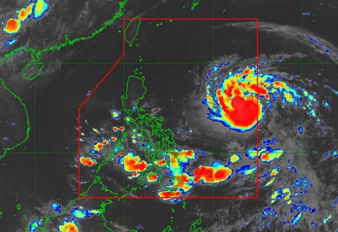
MANILA, Philippines – Severe Tropical Storm Francisco is forecast to intensify into a typhoon within the day, but is unlikely to hit the country directly, the state-run weather agency said on Sunday.
Weather specialist Robert Badrina of the Philippine Atmospheric Geophysical and Astronomical Services Administration (Pagasa) said 'Francisco', estimated at 1,315 kilometers east of southeastern Luzon, was moving west-northwestward at 25 kilometers per hour (kph) with maximum sustained winds of 100kph and gustiness of up to 125kph.
Expected to remain over the Philippine Sea throughout the forecast period, Francisco could make a closer approach to extreme Northern Luzon should the forecast track continue to shift westward, Badrina said during a 5 a.m. briefing.
Reiterating that the tropical cyclone would intensify into a typhoon on Sunday, Badrina said that Francisco was unlikely to affect the country's weather.
“However, the onset of heavy rains due to the southwest monsoon (habagat) and Francisco is possible beginning Monday,” according to the Pagasa forecaster.
The national weather bureau said that Wind Signal 1 may be hoisted in some localities in Cagayan, Babuyan Islands, and Batanes by Monday morning.
Pagasa said the trough or extension of Francisco is already affecting the Bicol region and Eastern Visayas.
Meanwhile, Mindanao, the rest of Visayas, and Palawan would have cloudy skies with scattered rain showers and thunderstorms due to habagat. Metro Manila and the rest of Luzon would have a similar weather pattern brought about by localized thunderstorms, it added.