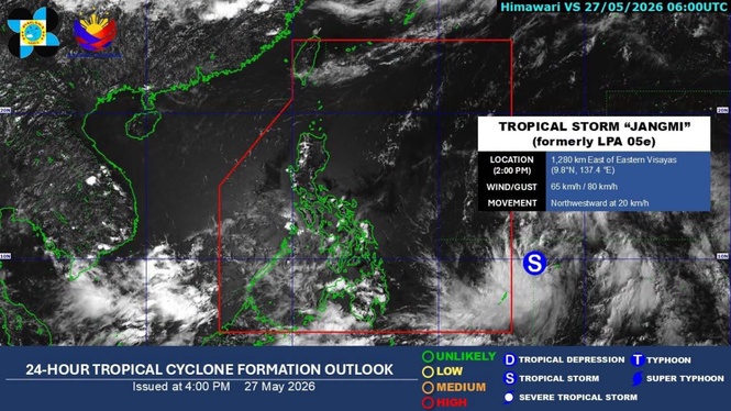
MANILA, Philippines – Tropical Storm "Jangmi" has been forecast to enter the Philippine Area of Responsibility (PAR) Thursday night as a severe tropical storm, according to the state weather bureau.
Nathaniel Servando, Philippine Atmospheric Geophysical and Astronomical Services Administration (Pagasa) chief, said that the weather disturbance has also the possibility of developing further into a typhoon by Saturday.
He told The Manila Times that its trough or extension has been affecting Davao Oriental and Davao Occidental where cloudy skies with scattered rains and thunderstorms would prevail.
“This weather disturbance is less likely to make landfall over the country. However, its periphery may still bring gusty conditions over extreme Northern Luzon,” Servando said.
The highest wind signal that may be raised during the passage of this tropical cyclone would be Signal No. 1, according to the national weather agency.
It may also enhance the southwest monsoon locally known as "habagat" starting on Saturday, according to the Pagasa administrator.