MANILA, Philippines —Tropical Storm Queenie could strengthen into a severe tropical storm in the coming hours or days and may reach typhoon category before or as it reaches the boundary of the Philippine Area of Responsibility (PAR), the state weather bureau said Friday.
The Philippine Atmospheric, Geophysical and Astronomical Services Administration (Pagasa) said in its 5 p.m. briefing that Queenie, internationally named Surigae, was moving west northwestward and would eventually turn northward before leaving the PAR on Sunday afternoon.
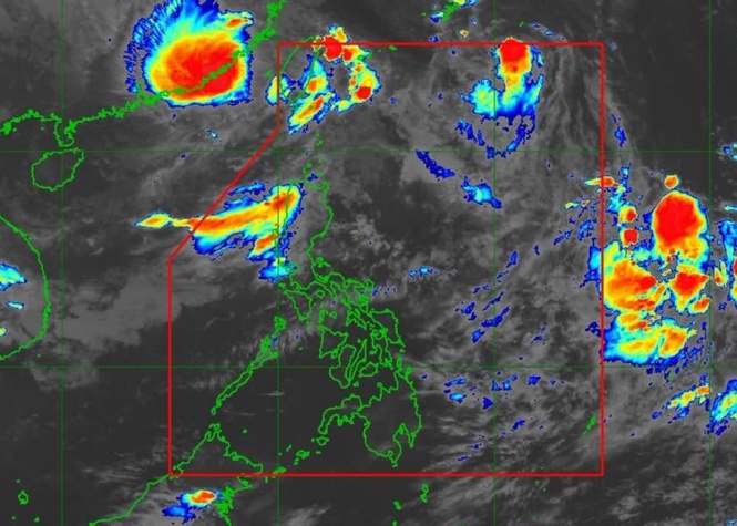
“As we can see, the cloud formations directly associated with Tropical Storm Queenie are limited and do not reach any part of our country,” DOST-Pagasa Weather Specialist John Manalo said in Filipino.
As of the latest update, Queenie was located 755 kilometers east of Basco, Batanes, with maximum sustained winds of 85 kilometers per hour near the center and gustiness of up to 105 kph, Manalo said.
It was moving west northwestward at 20 kph and was expected to eventually turn northeastward as it moves away from the country, he added.
Manalo said that Queenie's cloud formations remained limited and did not reach any part of the country.
“Although it has moved slightly closer to Extreme Northern Luzon, it will still have no effect,” Manalo said in Filipino.
According to Pagasa, the forecast track had shifted slightly eastward, resulting in an earlier projected exit from the PAR.
He said Queenie could strengthen further in the coming hours or days.
“It may strengthen into a severe tropical storm, and before it exits, or when it reaches the boundary of the PAR, it may strengthen further into typhoon category,” Manalo said in Filipino.
The weather bureau stated that the waves that Queenie could contribute to Extreme Northern Luzon were not expected to be particularly strong or large.
No gale warning was raised, but Manalo advised fishermen and people traveling by sea in Extreme Northern Luzon, particularly in Batanes and the Babuyan Islands, to exercise caution, especially those using small boats.
Meanwhile, the Intertropical Convergence Zone, or ITCZ, is affecting Mindanao, bringing a higher chance of rain in areas under its influence.
Manalo said widespread rainfall that could cause widespread flooding was not expected over Metro Manila and the rest of the country. Convective activity, however, could bring thunderstorms, including those experienced in parts of Metro Manila.
He said similar weather conditions could continue through the weekend and into next week.
The next tropical cyclone bulletin on Queenie will be issued at 11 p.m. Friday.