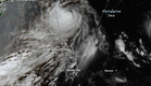
MANILA, Philippines – The state-run weather agency said on Wednesday that Wind Signal No. 1 remains hoisted over the provinces of Batanes and Cagayan due to Typhoon Francisco, which continues to weaken while lingering over the Philippine Sea.
Nathaniel Servando, Philippine Atmospheric, Geophysical and Astronomical Services Administration (Pagasa) chief, said Francisco's eye was estimated at 350 kilometers (kms) east-northeast of Calayan, Cagayan, or 275kms east of Basco, Batanes.
Moving northward at 10 kilometers per hour (kph), Francisco has maximum sustained winds of 155kph near the center and gustiness of up to 190kph, according to the latest Pagasa bulletin.
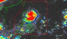
Citing the track forecast, Servando said the typhoon will exit the Philippine Area of Responsibility (PAR) by Thursday evening or Friday morning.
The national weather agency said the typhoon has also been affecting Ilocos Region, Cordillera Administrative Region, and the rest of Cagayan Valley, bringing cloudy skies with scattered rain showers and thunderstorms.
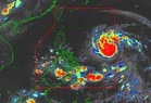
On one hand, the southwest monsoon or ‘habagat’ has been bringing the same weather pattern over Metro Manila, Central Luzon, CALABARZON (Cavite, Laguna, Batangas, Rizal and Quezon), MIMAROPA (Mindoro, Marinduque, Romblon and Palawan), Bicol Region, Western Visayas, and Negros Island Region in 24 hours, it added.
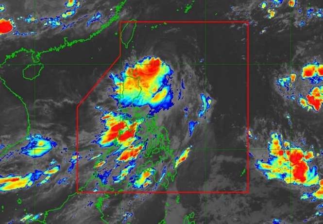
Meanwhile, Servando said that Pagasa is closely monitoring the movement of Tropical Storm Higos (international name), which was outside PAR, and is unlikely to hit the country.