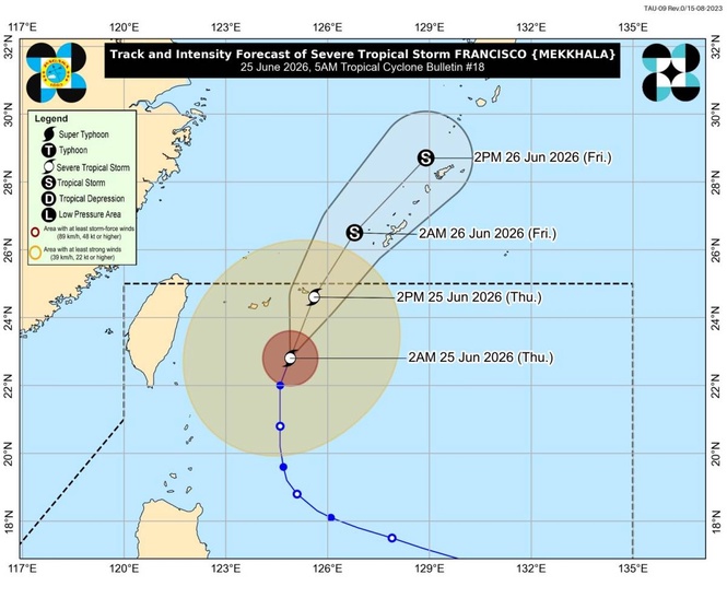
MANILA, Philippines — Tropical Cyclone "Francisco" has been downgraded into a severe tropical storm as it was forecast to exit the Philippine Area of Responsibility (PAR) either Thursday afternoon or evening, according to the state weather bureau.
Weather specialist Leanne Loreto of the Philippine Atmospheric, Geophysical and Astronomical Services Administration (Pagasa) said in a 5 a.m. briefing that Signal No. 1 remained hoisted over Batanes.
Moving north-northeastward, the severe tropical storm was estimated at 415 kilometers northeast of Itbayat, Batanes while packing maximum sustained winds of 100 kilometers per hour (kph) near the center and gustiness of up to 125kph, she said.
Meanwhile, the Pagasa forecaster said Tropical Storm "Higos" (international name) has been forecast to enter PAR within the day but would also exit the region Friday morning.
“Higos would be renamed ‘Gardo’ for its domestic name and would be the seventh storm to hit the country this year,” Loreto said.
Over the next 24 hours, the state-run weather agency said most parts of Luzon and the Visayas would be affected by the southwest monsoon or "habagat" which would bring occasional and scattered rains and thunderstorms.
On one hand, Mindanao will be experiencing partly cloudy to overcast skies with isolated rain showers or thunderstorms due to the effect of the localized thunderstorms, it added.