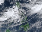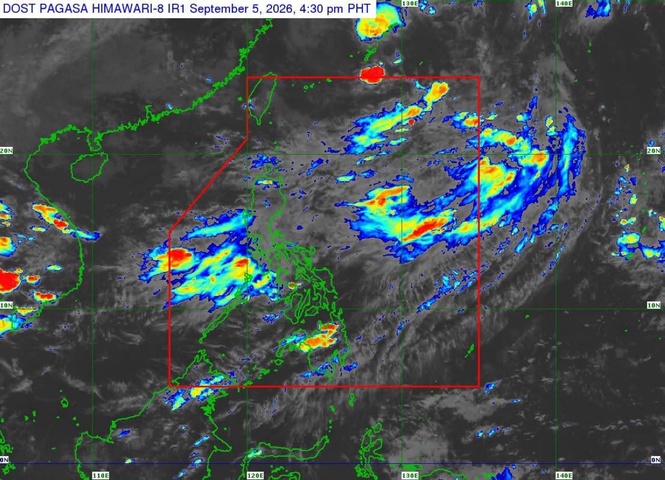
MANILA, Philippines — The southwest monsoon or "habagat" is expected to bring 50 to 100 millimeters of rain over several areas in Luzon through Tuesday, the Philippine Atmospheric, Geophysical and Astronomical Services Administration (Pagasa) said Saturday.
In its 5 p.m. weather advisory, the weather bureau said that Zambales, Bataan, Tarlac, Pampanga, Bulacan, Metro Manila, Cavite, Rizal, Batangas and Occidental Mindoro may receive 50 to 100 mm of rain from Saturday until Sunday afternoon.
From Sunday afternoon to Monday afternoon, the same rainfall range is expected over Zambales, Bataan, Tarlac, Pampanga, Cavite, Batangas and Occidental Mindoro.
From Monday afternoon to Tuesday afternoon, Ilocos Sur, La Union, Pangasinan, Abra, Benguet, Zambales, Bataan, Tarlac, Pampanga, Cavite, Batangas and Occidental Mindoro may receive 50 to 100 mm of rain.
Pagasa said rainfall may be higher in mountainous and elevated areas. The impact in some areas may also be worsened by significant rainfall already received.
Pagasa Regional Services Divisions may issue heavy rainfall warnings, thunderstorm advisories and other severe weather information for specific areas as needed.
Tropical storm Krovanh may enhance Habagat
Meanwhile, Tropical Storm Krovanh, formerly known as Pilandok, was outside the Philippine Area of Responsibility as of Saturday afternoon and was not expected to directly affect the country's weather or sea conditions over the next three days.
Also at 5 p.m. Tropical Cyclone Advisory, Pagasa said Krovanh was 810 kilometers northeast of extreme Northern Luzon, over the coastal waters of Okinawa, Japan.
The storm had maximum sustained winds of 65 kilometers per hour (kph) near the center, gustiness of up to 80 kph and was moving southeastward at 25 kph.
Strong to gale-force winds extended up to 550 kilometers from the storm's center.
Pagasa said that Krovanh would first move southeast, then turn northeast and leave the PAR by Monday before heading north toward southern Japan.
The storm is expected to maintain tropical storm strength until Monday and weaken into a tropical depression by Tuesday.
While landfall over the Philippines remains unlikely, the weather bureau said Krovanh may enhance the southwest monsoon over Luzon and the Visayas in the coming days.
The next weather advisory and tropical cyclone advisory are scheduled for 11 p.m.