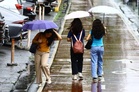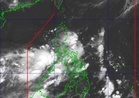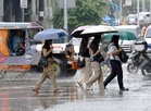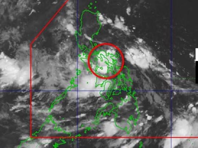
MANILA, Philippines — The state-run weather agency reiterated on Tuesday that the low pressure area (LPA) off Masbate has a big chance to intensify into a tropical cyclone anytime of the day and is forecast to hit Southern Luzon and the Visayas.
Weather specialist Chenel Dominguez of Philippine Atmospheric, Geophysical and Astronomical Services Administration (Pagasa) chief, said the LPA was estimated to be over the coastal waters of San Pascual, Masbate.
Once it develops into a tropical depression it would be named ‘Henry’ and Signal No. 1 would be immediately raised over areas in Southern Luzon and the Visayas, Dominguez said during a 5 a.m. briefing.
The LPA, she said, has already been affecting Metro Manila, Visayas, CALABARZON (Cavite, Laguna, Batangas, Rizal and Quezon), Bicol Region, Occidental Mindoro, Oriental Mindoro, Marinduque, and Romblon where cloudy skies with scattered rains and thunderstorms would prevail.
The Pagasa forecaster warned that flash floods or landslides due to moderate to heavy rains would be possible in these areas.
Meanwhile, the southwest monsoon or ‘habagat,’ which has been on its weakening stage, is only affecting Palawan at which overcast skies with scattered rains and thunderstorms would be likely.
The rest of the country, according to the national weather bureau, would be experiencing partly cloudy to cloudy skies with isolated rain showers or thunderstorms due to the localized thunderstorms.