MANILA, Philippines — The Philippine Atmospheric, Geophysical and Astronomical Services Administration (Pagasa) forecast a high chance of rains in some areas.
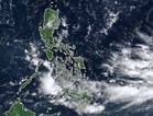
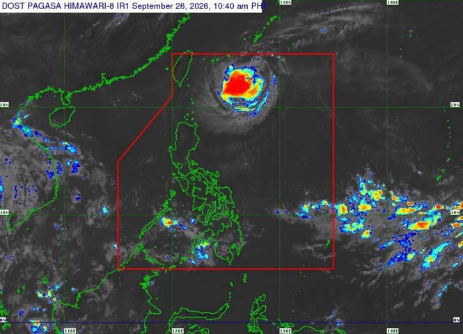
Pagasa Weather Specialist Benison Estareja said in Filipino and English in the 5 p.m. weather update that rains continued in a big part of Palawan, the Visayas, and Mindanao because of the Intertropical Convergence Zone (ITCZ) and that the chance of light to moderate with at times heavy rains was high up to early Wednesday morning.
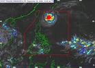
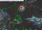
Citing Pagasa's latest satellite animation, he said that the chance of light to moderate rains was high overnight over Batanes and Cagayan provinces.
As to the rest of Luzon including Metro Manila, he told the public to expect partly cloudy and sometimes cloudy skies. He added that there was "a chance of isolated rainshowers due to localized thunderstorms."
Estareja said the Philippines was in the transition period between the habagat (southwest monsoon) season and amihan (northeast monsoon) season.
"So we are not yet in the so-called cool and dry season wherein less rains can be expected by November to the first quarter of next year," he said.
Estareja said that on Wednesday, the ITCZ would bring rains to a big part of Palawan, the Visayas, and Mindanao.
Based on the forecast, light rains were possible as early as Wednesday morning in southern Palawan, Central Visayas, Negros Island Region, and the northern part and western sections of Mindanao.
"Then by noon to evening, it will be more overcast in a big part of Palawan, Visayas, and Mindanao and the chance of heavy rains and thunderstorms...will be higher," he said.
Estareja told the public to expect a "high chance of cloudy skies and light to moderate rains in" on Wednesday in Batanes, Cagayan, and parts of Apayao because of the northeasterly windflow.
He said that in the rest of Luzon including Metro Manila, the skies on Wednesday would be partly cloudy and sometimes cloudy from morning to early afternoon.
Based on the forecast, light rains were possible in eastern Luzon including Isabela, Aurora, Quezon, and Bicol. The rest of Luzon including Metro Manila could have isolated to moderate rains with localized thunderstorms were possible in the afternoon or evening on Wednesday.
A gale warning was raised over the seaboards of extreme north Luzon (Batanes). Pagasa said in its warning, issued at 5 p.m. on Tuesday, that strong to gale-force winds "are prevailing or expected to affect the" seaboards of the said area. Wave heights could reach 4.5 meters which Estareja said was "dangerous for our small sea vessels, especially" fishers.
He told the public to expect moderate wave heights in the coastal waters of Cagayan Valley, Aurora, Quezon, and Bicol.
Seas could be slight to moderate as to the coastal waters in the West Philippine Sea, the Visayas, and Mindanao, based on information from the weather update.