MANILA, Philippines — The Philippine Atmospheric, Geophysical and Astronomical Services Administration (Pagasa) forecast that weather conditions in Luzon on Thursday would be similar to those experienced on Wednesday.
"So expect tomorrow, morning to noon, fair weather, or no continuous heavy rains are expected," Estareja said.
Hot and humid weather was expected by noon. Pagasa forecast up to 33 degrees Celsius in Metro Manila, Tuguegarao, and Legazpi in Albay.
Estareja said that by afternoon up to evening, especially between 2 p.m. and 12 midnight, rains and thunderstorms are expected. "Because it will be very hot by day, there will be tendency for moisture to be gathered and to evaporate into thunderstorm clouds. So sometimes, rains will be heavy by the afternoon and evening," he said.
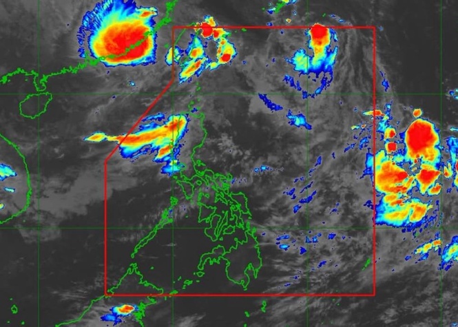
Esteraja said that in Leyte and Southern Leyte, the chance of rain was highest because of the trough of the tropical depression. "Meaning, as early as [Thursday] morning, light to moderate with at times heavy rains are expected," he said, adding that the rain could further intensify by afternoon up to evening.
As to the rest of the Visayas and Palawan, he told the public to expect partly cloudy and sometimes cloudy skies from morning up to noon. Increased cloudiness "by afternoon up to evening" with isolated rainshowers or thunderstorms was expected.
Rain was expected in the eastern part of Mindanao on Thursday because of the trough.
"That includes Northern Mindanao especially Eastern portions of Camiguin and Misamis Oriental as well as in almost the entire Caraga Region and in the Davao Region. Expect a high chance of rains from morning up to evening," Estareja said.
As to the rest of Mindanao, Pagasa forecast partly cloudy to cloudy skies in the morning. Rains or thunderstorms that are not continuous were expected by afternoon up to evening, Estareja said.
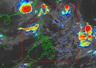
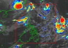
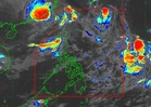
Based on data shown in the forecast, the tropical depression was 1,810 kilometers east of southeastern Luzon as of 3 p.m. and was moving north northwestward at 15 kilometers per hour (km/h) with maximum sustained winds of 55 km/h near the center and gustiness reaching 70 km/h.
Estareja said that up to early Thursday morning, the chance of rain was high in Eastern Visayas, Caraga, the Davao Region, almost the entire Northern Mindanao, and Sarangani.
As to the rest of the country including Metro Manila, he said that thunderstorms were expected overnight.
Estareja said that the tropical depression could enter the Philippine Area of Responsibility (PAR) on Thursday morning "as a tropical storm." It would be locally called Queenie.
It would intensify over the Philippine Sea when it enters the PAR, he said.
"And it is possible that on Saturday or Sunday, it is already in the typhoon category," he said.
On Sunday and Monday it would be nearest "so far" to Batanes and the Babuyan Group of Islands.
Pagasa has not ruled out landfall in extreme north Luzon. "However, if it does not make landfall, it is expected that on Sunday or Monday, moderately strong winds and rains will be felt especially in Batanes and the eastern portion of Cagayan including the Babuyan Islands.